|
|
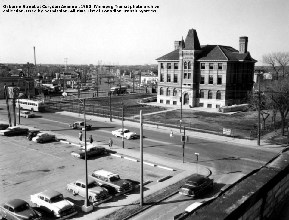
(above) Osborne Junction, circa 1960. A CanCar motorbus waits southbound on
Osborne Street at the corner of Corydon Avenue while another bus
enters the intersection of Corydon and Pembina, westbound.
Three passengers stand at the northbound stop on Osborne Street.
Gladstone School will soon be demolished to allow Pembina to be extended another
block north to meet Osborne at McMillan, creating "confusion corner".
Winnipeg Transit photo.
|

|
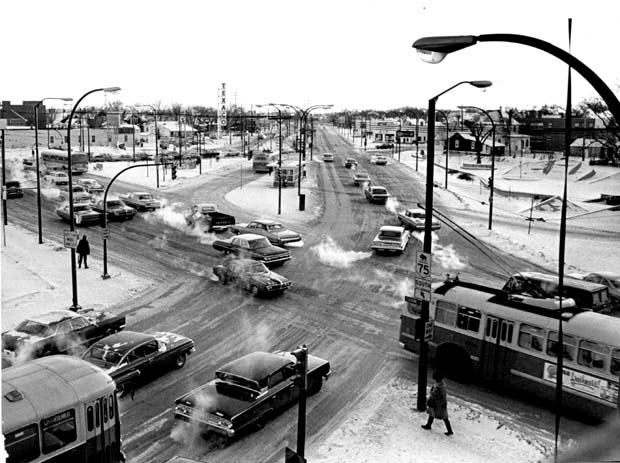
(above) Osborne Junction, circa 1968. One CCF-Brill trolley bus at the centre island stop prepares to
depart on the
Corydon route while another heads north on Osborne street towards the city centre. A CanCar gas bus
waits on McMillan Avenue at the light, for access to the centre island stop. A GM "new look" heads south
on the Osborne route.
One passenger waits at the northbound Osborne Street stop, in almost exactly the same place as the trio in the first picture.
Winnipeg Tribune photo archives.
|

|
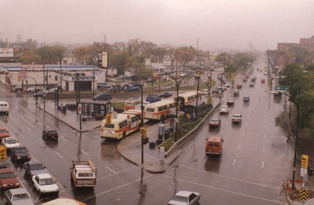
(above) Osborne Junction, 1999. Three New Flyer model D40 buses board outbound passengers at the centre
island platform. From the centre island buses depart westward on Corydon and Grant services, and southbound
on Pembina and Richmond routes. Notice the "transit trailer" on
the sidewalk left of the middle bus. Winnipeg Transit used the tiny trailers
to position employees making passenger counts.
Alex Regiec photo. Used by permission.
|

|
|
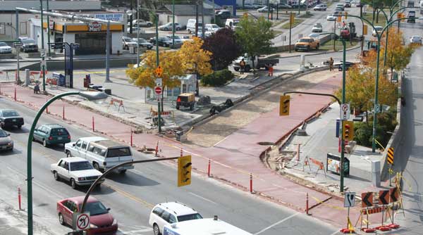
(above) Osborne Junction, October 2007. In the fall of 2007 Osborne Junction
was further modified by the addition of red pavement demarcating the transit-only
spaces at the intersection.
Alex Regiec photo. Used by permission.
|
Copyright ©2007-2008 David A. Wyatt. Photograph copyrights belong to the photographers.
This page last modified: Thursday, 25-Sep-2014 16:20:43 CDT


