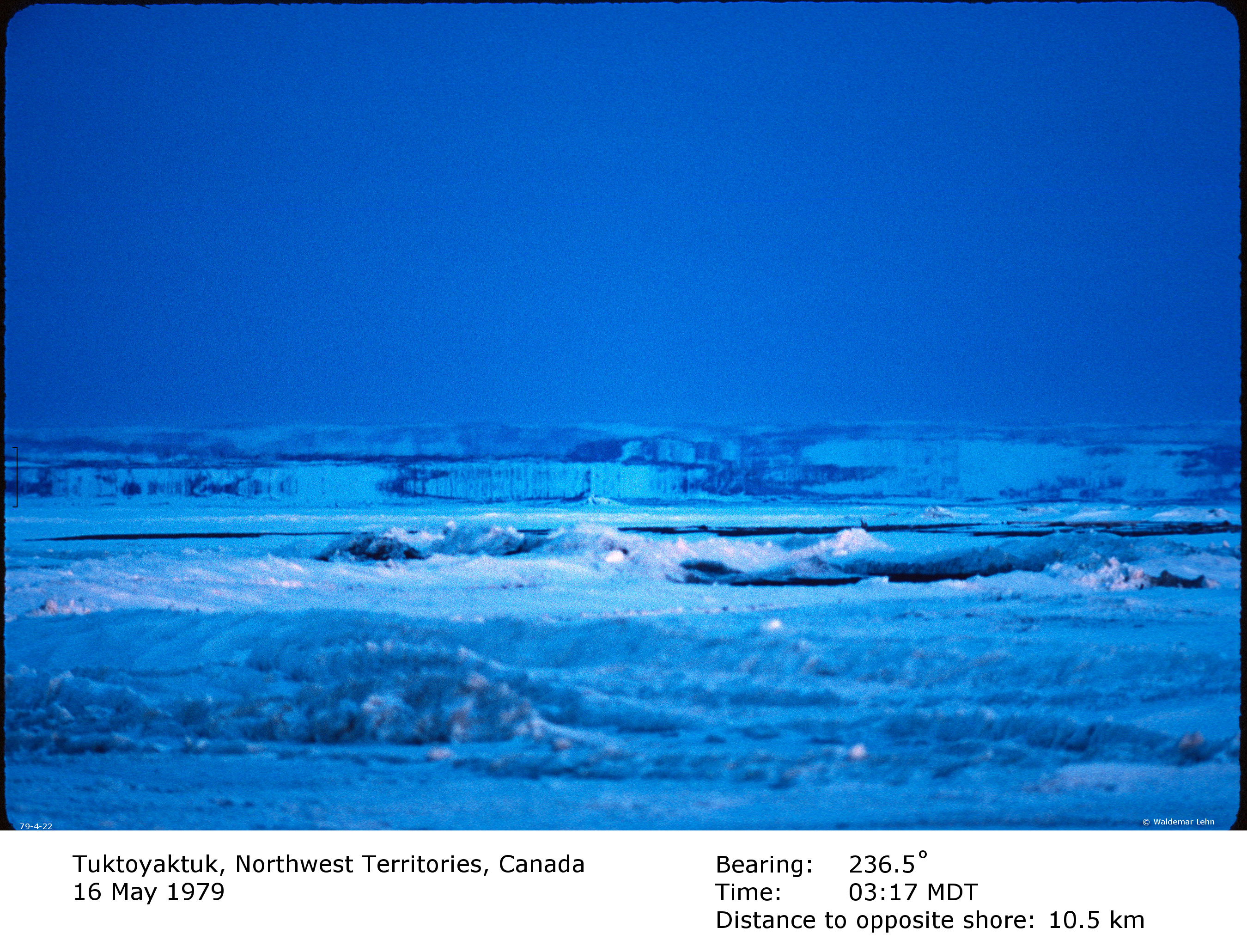
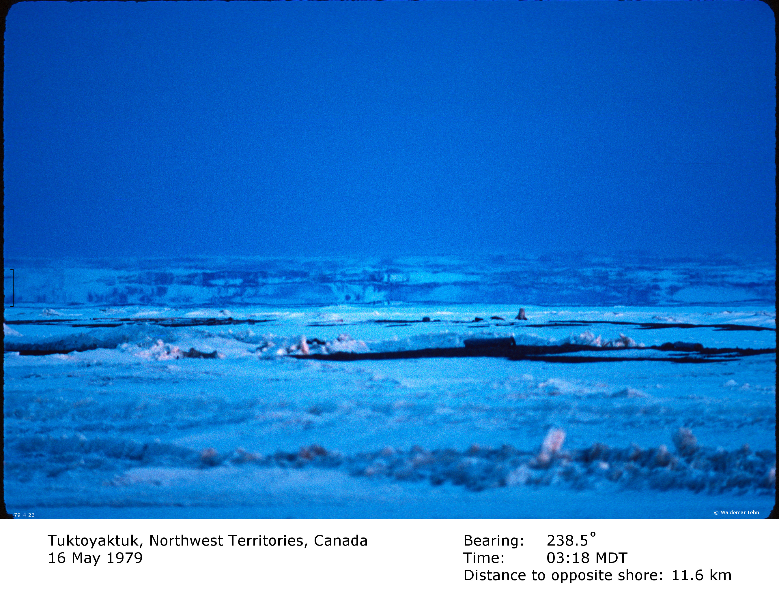
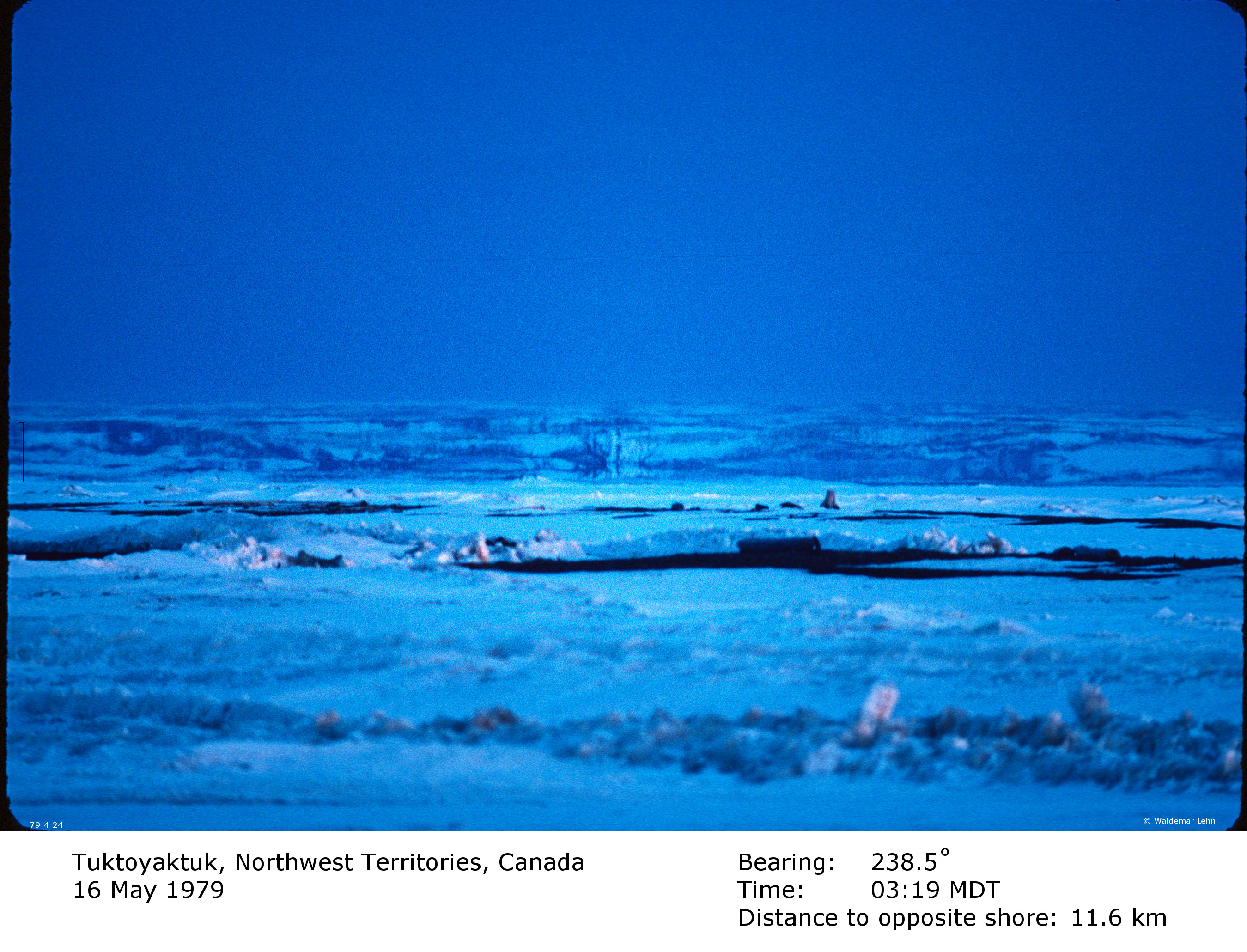
Mirages observed at Tuktoyaktuk, Northwest
Territories, Canada on 16 May 1979
The following photographs present mirages
photographed in the early morning hours of 16 May 1979.
Permission is granted to use these images for further research
and/or publication, on condition that the source is clearly
acknowledged.
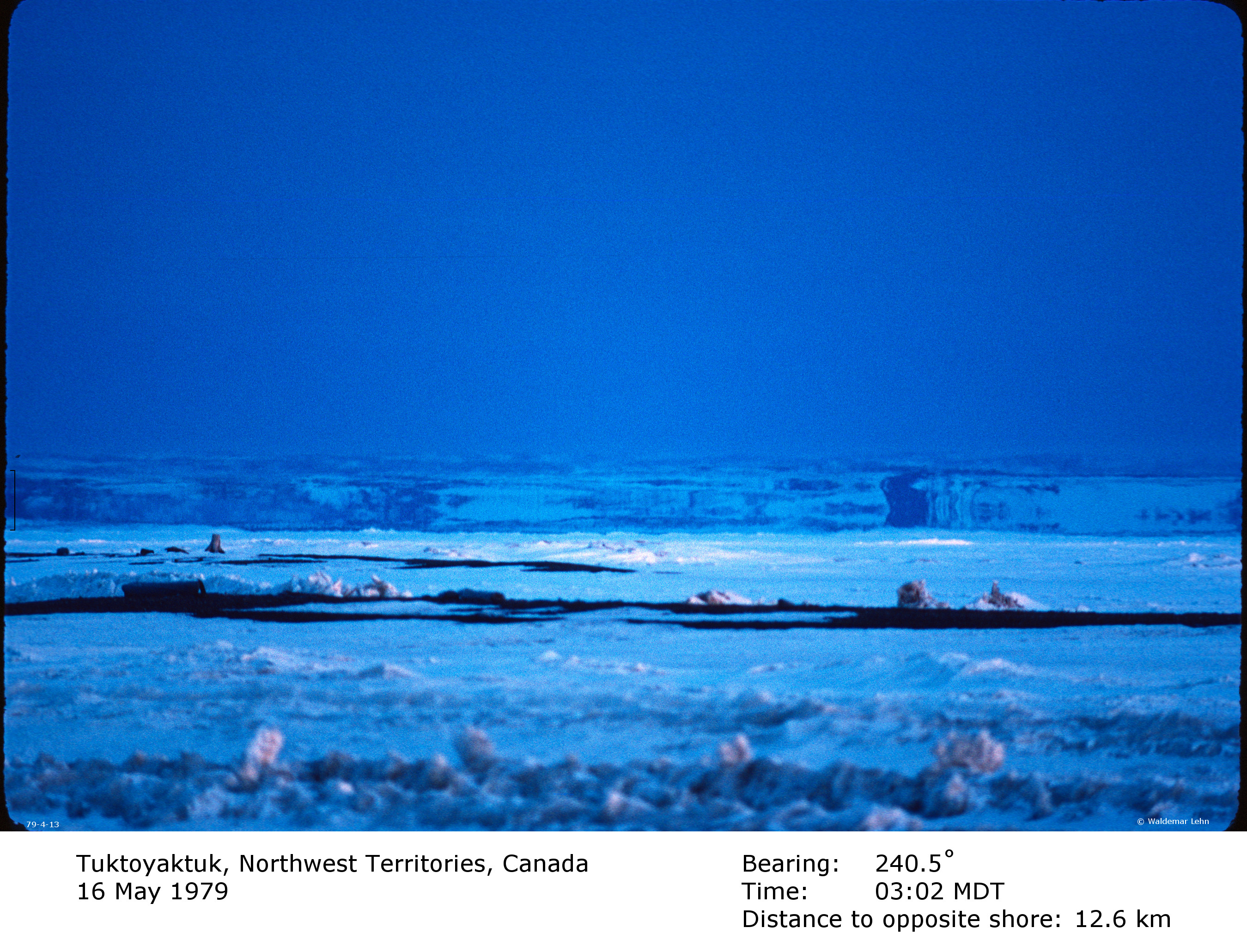
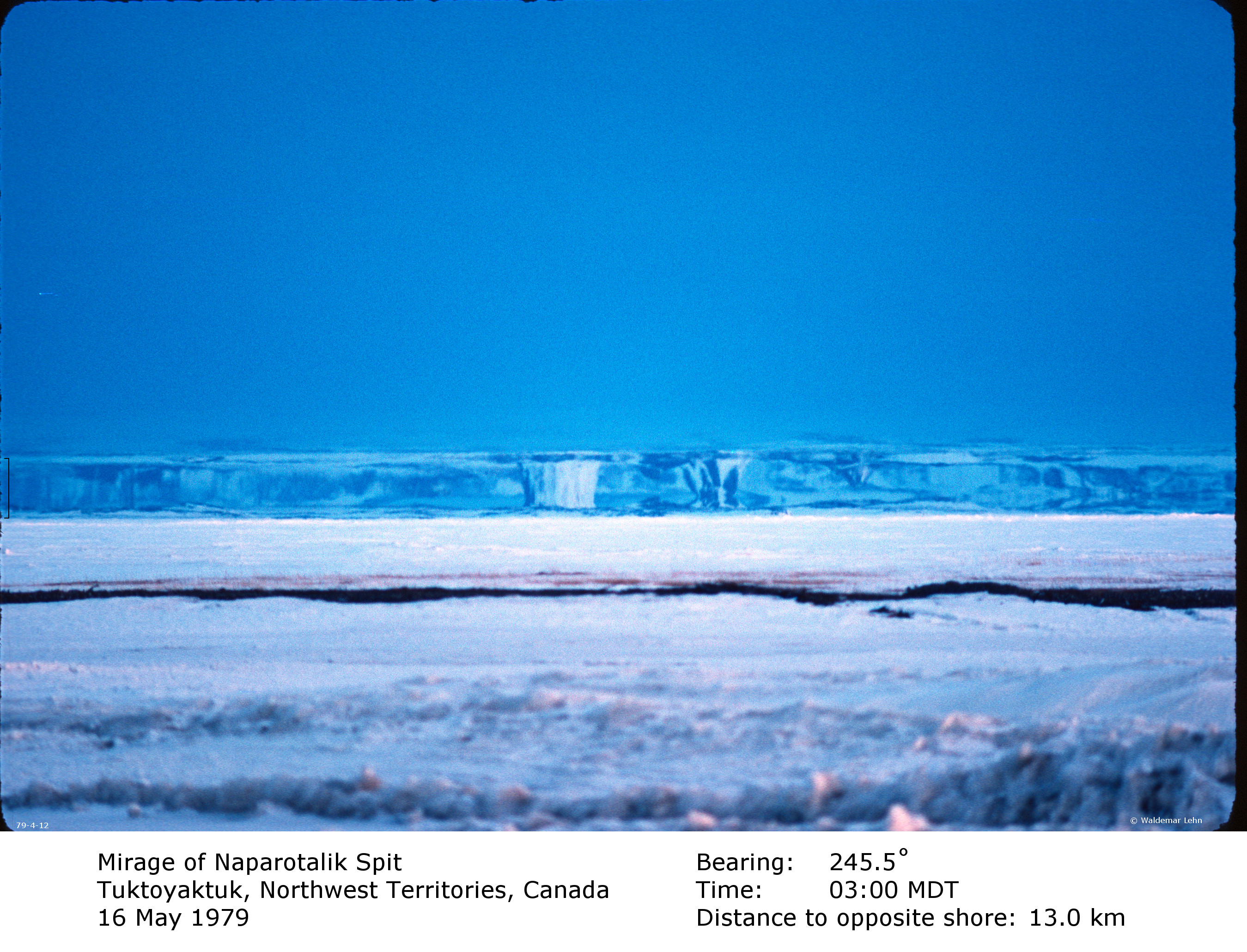
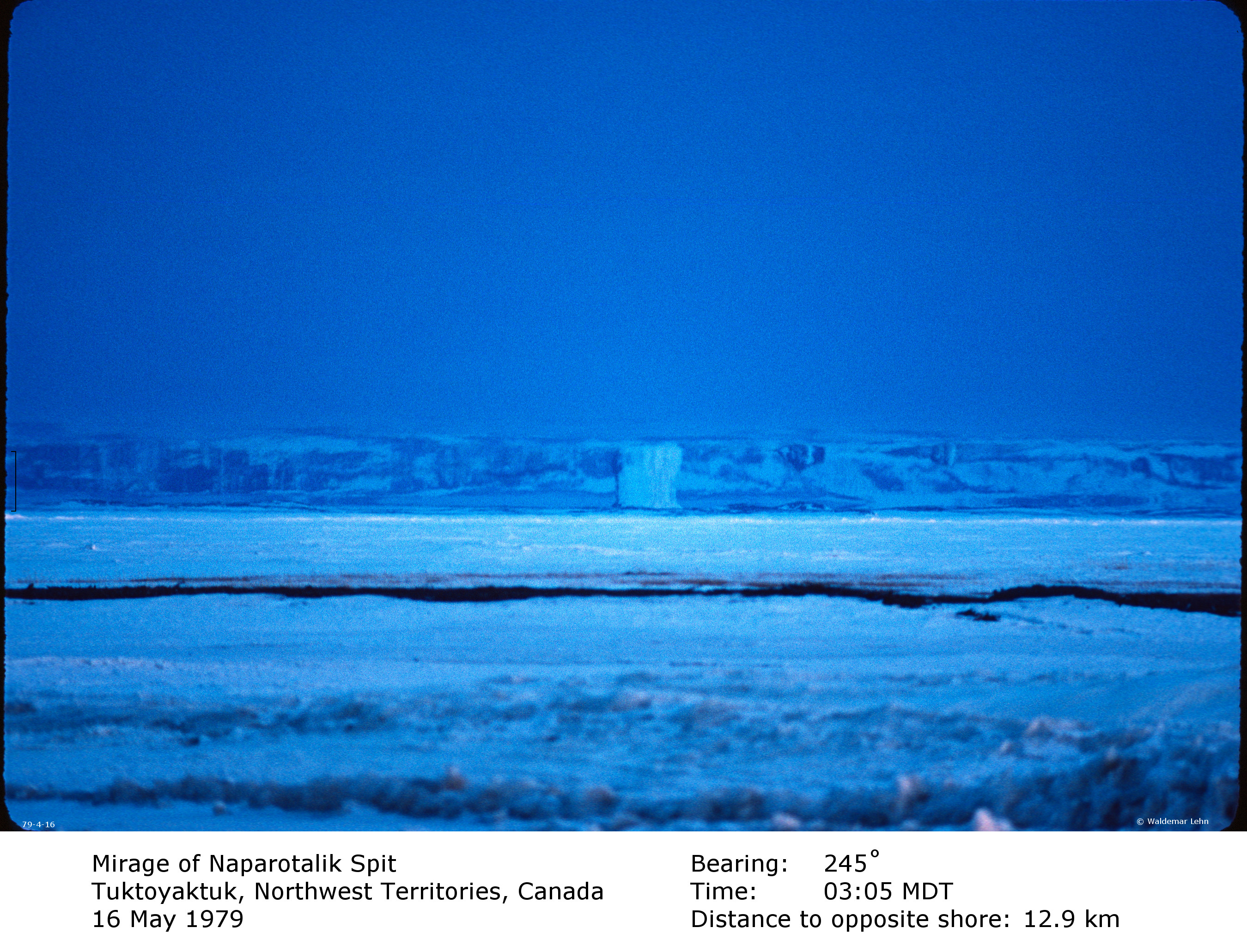
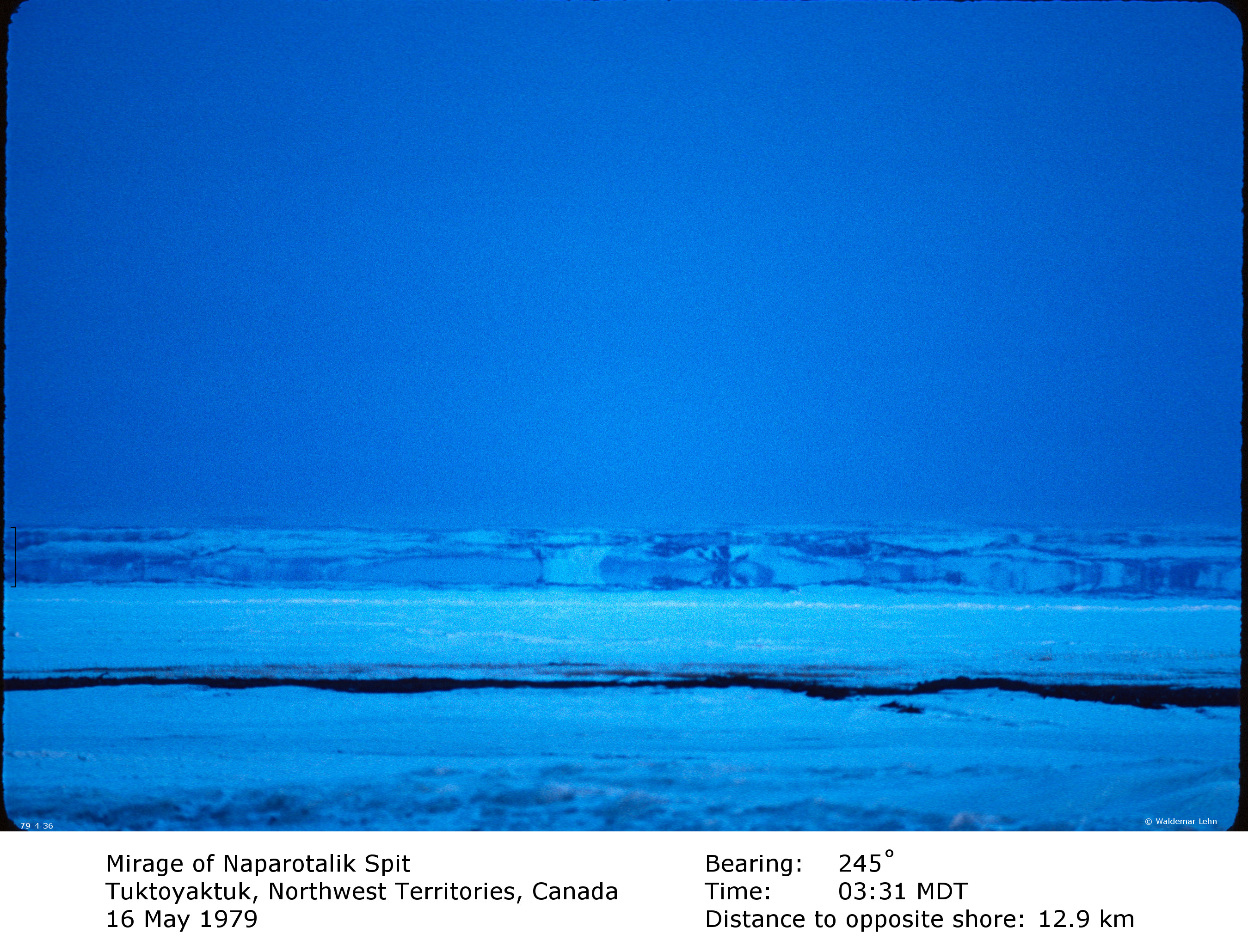
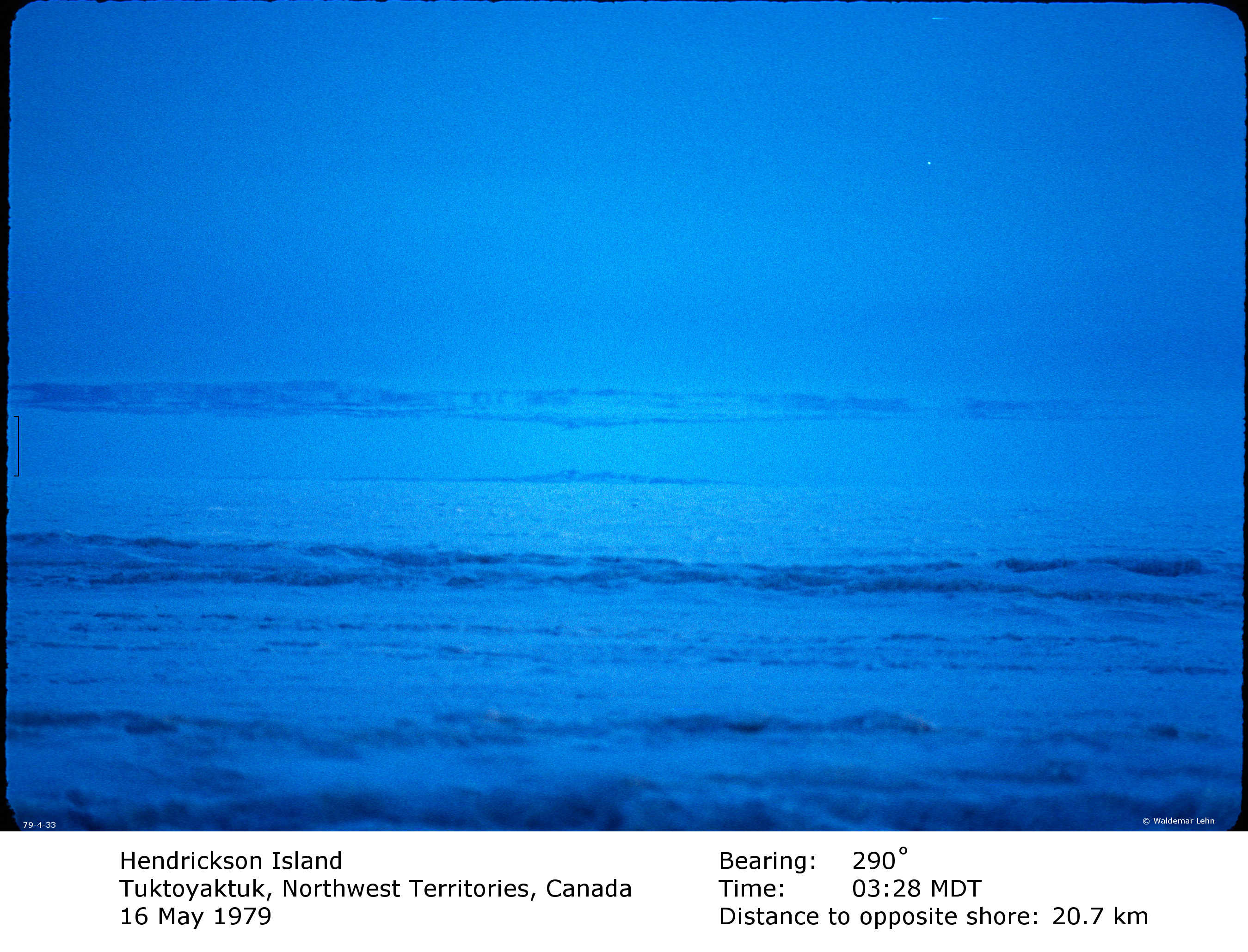
Shortly before these images were recorded, the
Novaya Zemlya effect (a premature
return of the midnight sun) had been
observed and photographed. This has been reported in some detail
in a paper by Lehn
and German. The effect is caused by an optical duct in the
atmosphere, created by a well defined surface layer of cold air
that lies below distinctly warmer air. The duct captured nearly
horizontal light rays and transmitted them around the curve of
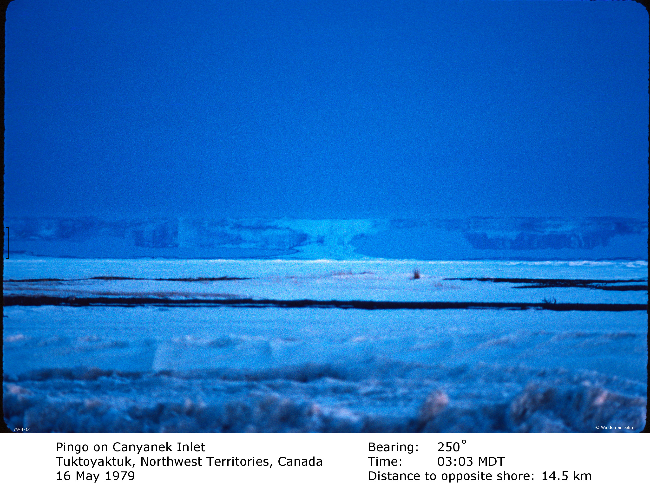
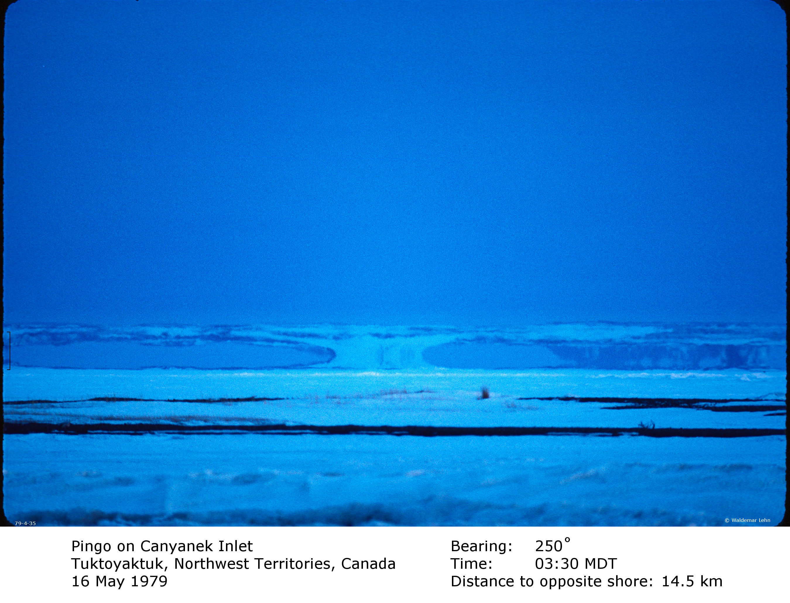
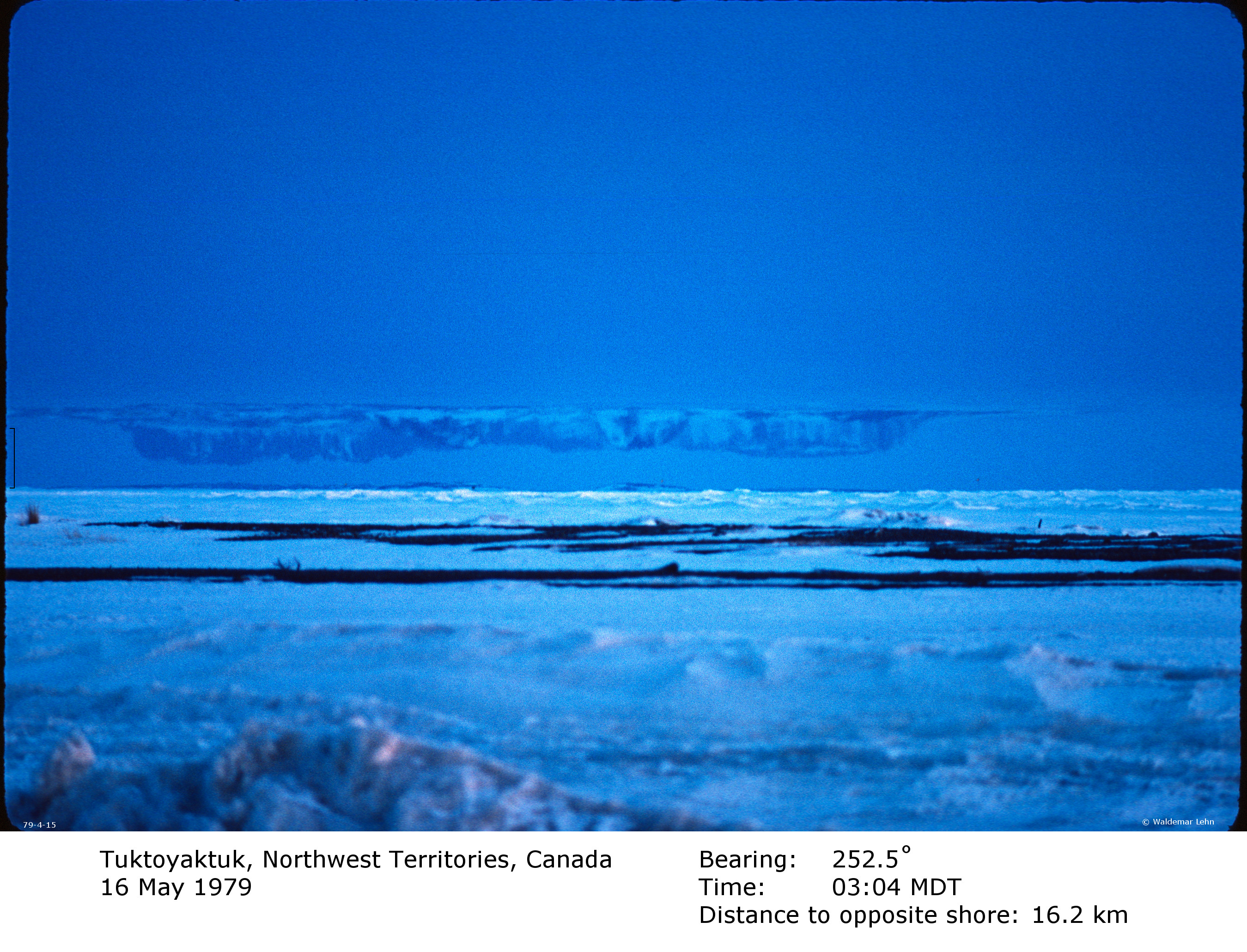
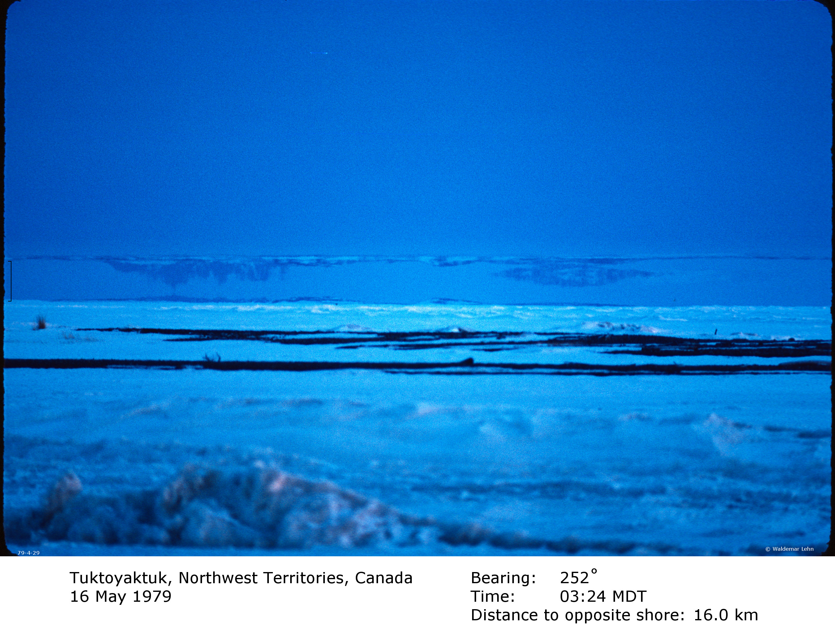
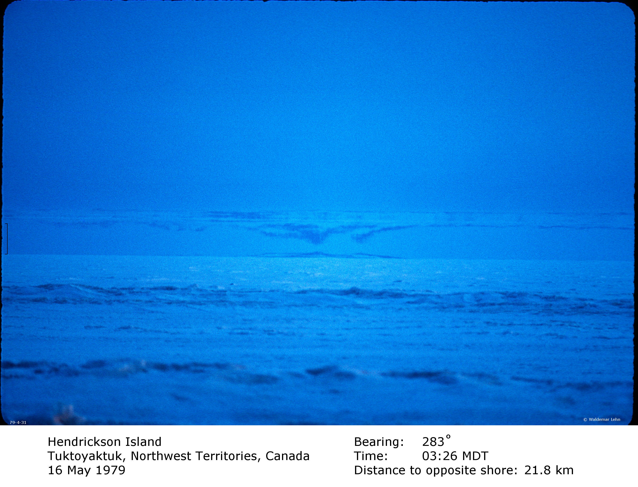
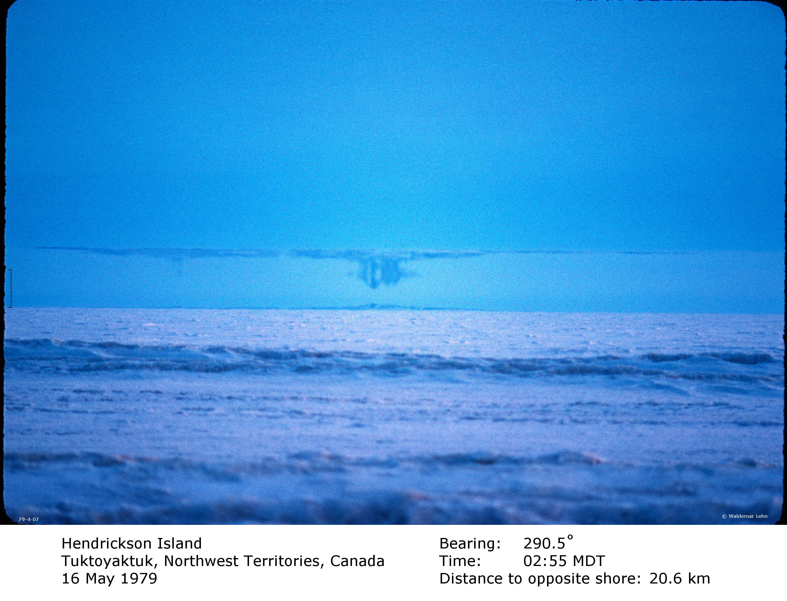
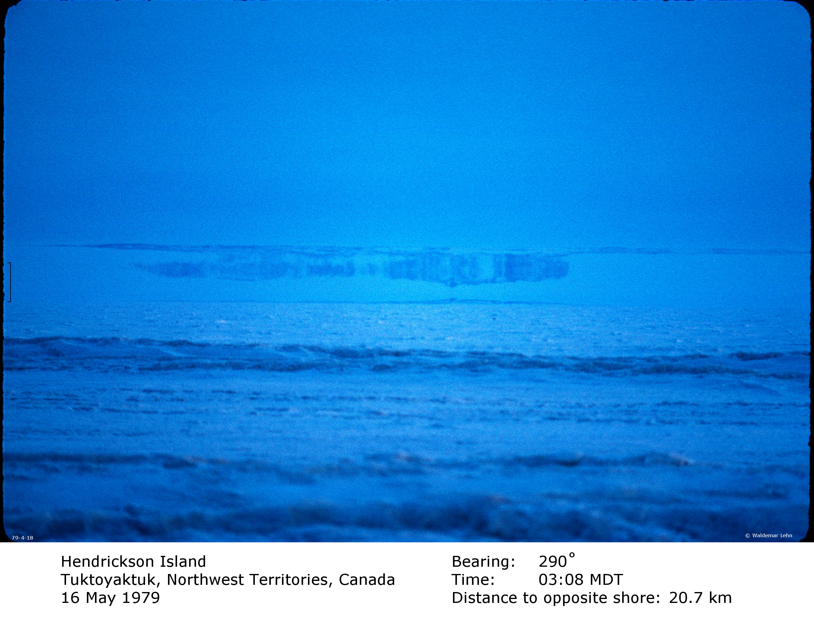
the Earth. The duct also produced the terrestrial mirages shown
below, in which objects are extremely distorted, often beyond
recognition. The duct itself is visible as a grayish band
resting on the horizon. The mirages appear within this band.
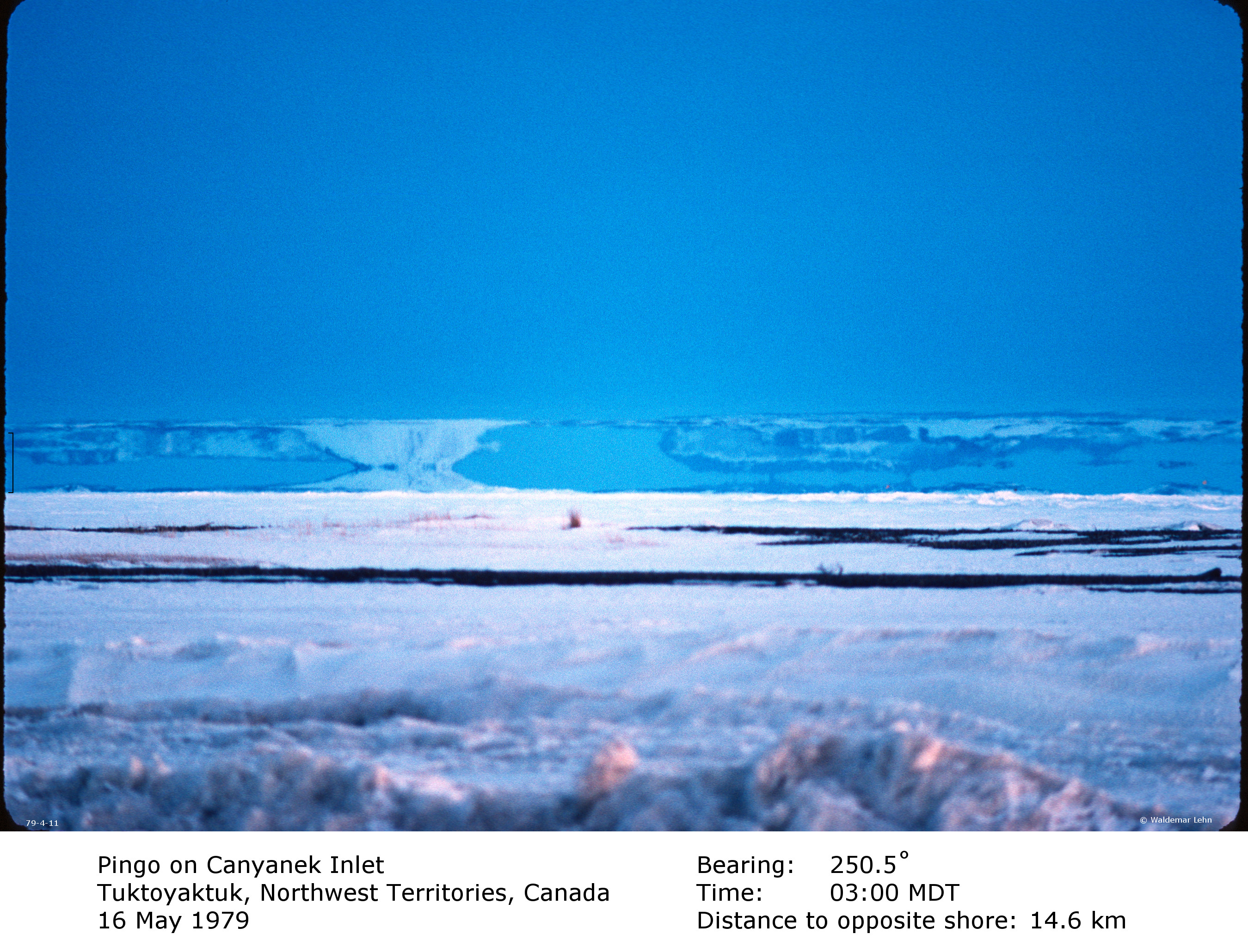
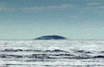
The landscape in the photographs is the Mackenzie
River delta, where the river flows into the Beaufort Sea. The land has a low
profile, with elevations generally not exceeding 30 m above sea
level. One of the dominant features is a great profusion of
pingos; a pingo is a low rounded hill, usually
covered with detritus and scrub vegetation, whose core is a
flattish lens of ice left over from the last Ice Age. The example
shown here has a peak elevation under 20 m.
At the time of the observations, the sky was clear,
the wind calm, the atmospheric pressure 101.0 kP, and the
surface temperature about 2º C.
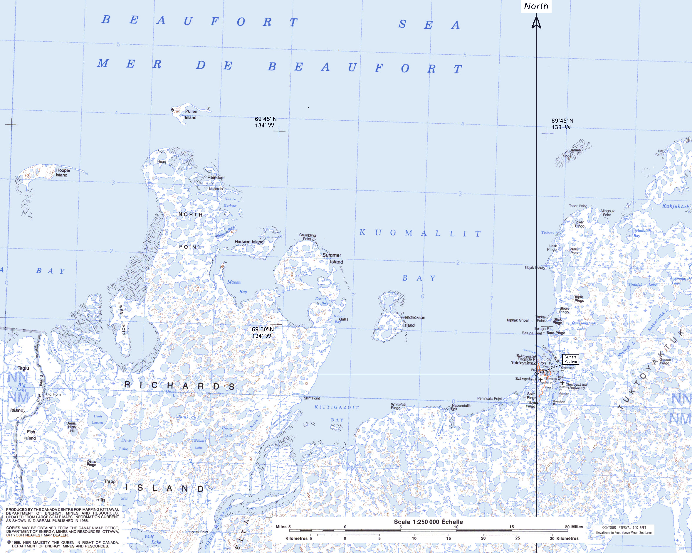
The coordinates of
the observation point were69º
26´18˝ N, 133º 02´20˝ W. This point is marked on the map. Also
shown is the Due North line passing through this point, relative
to which the true bearings of lines of sight can be measured. The
map itself is a portion of the standard 1:250000 sheet entitled
"Mackenzie Delta, Map 107C, Energy Mines and Resources Canada." It
is available from the Canadian Government website
http://www.geogratis.cgdi.gc.ca/.
Details of
the photography:
The images were captured on Kodachrome 64
film. On the camera was a 560 mm f/6.8
lens, positioned at an elevation of 2.5 m above sea ice level. Typical
exposure was 1/15 sec at f/6.8. All lines of
sight passed across the frozen Beaufort Sea.
The images are full frame scans, 2700 x 1800
pixels. An angular scale has been inserted near the
left edge of each image; it represents 10 arcminutes.
Click on an image to see the
full-sized version. The images are arranged according to bearing
angle.
 nd has a low
profile, with elevations generally not exceeding 30 m above sea
level. One of the dominant features is a great profusion of
pingos; a pingo is a low rounded hill, usually
covered with detritus and scrub vegetation, whose core is a
flattish lens of ice left over from the last Ice Age. The example
shown here has a peak elevation under 20 m.
nd has a low
profile, with elevations generally not exceeding 30 m above sea
level. One of the dominant features is a great profusion of
pingos; a pingo is a low rounded hill, usually
covered with detritus and scrub vegetation, whose core is a
flattish lens of ice left over from the last Ice Age. The example
shown here has a peak elevation under 20 m.