The maps below show the approximate historical locations of Algonquian language varieties. The maps are intended only to give a general sense of the geographical distribution of the languages. Clicking on an image will load the full-sized version.
Jump to: Algonquian family | Algic family | Cree/Ojibwe | Eastern Algonquian
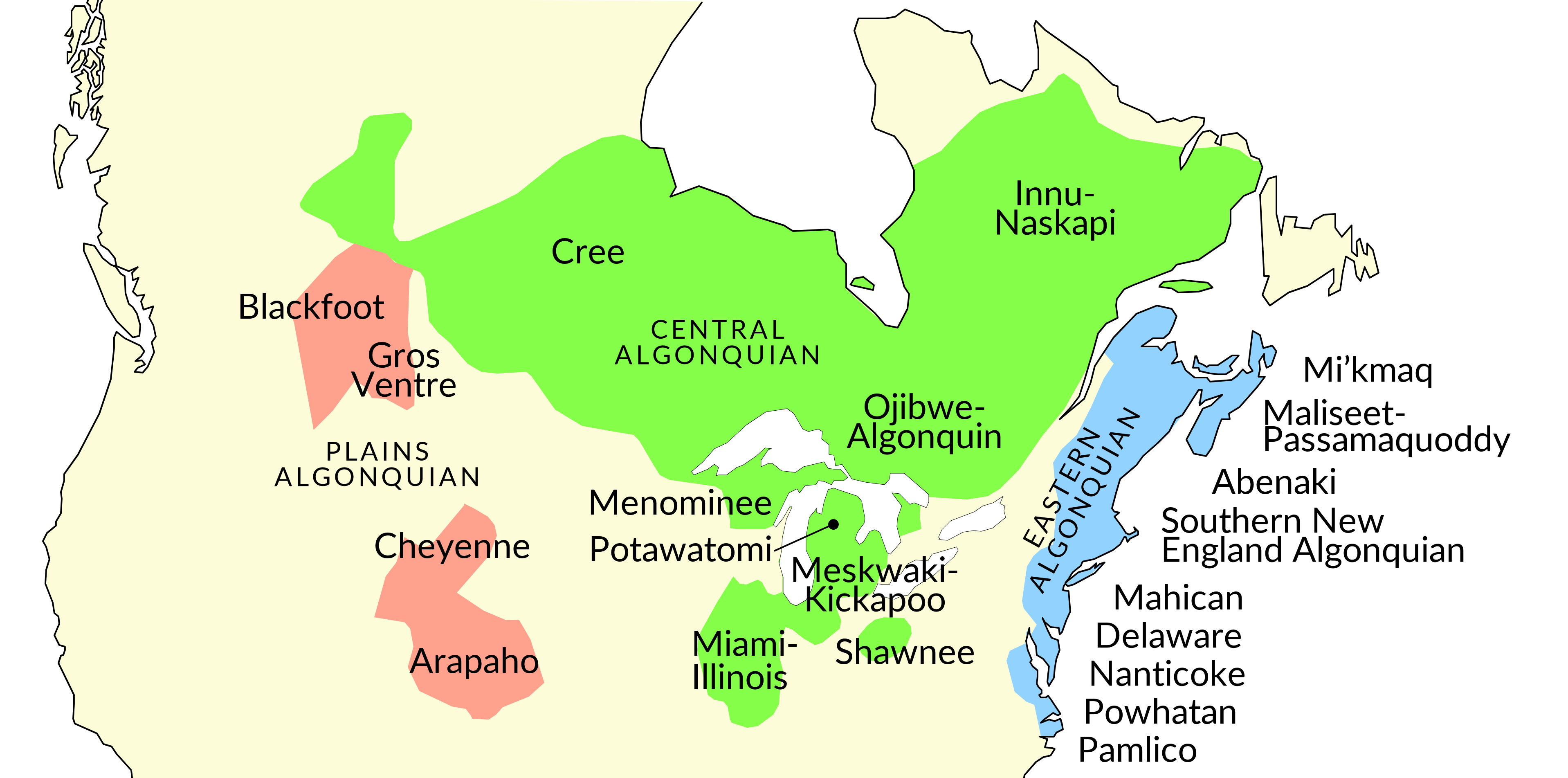
Algonquian family
Drawn by Will Oxford. Language locations based on Goddard 1999.
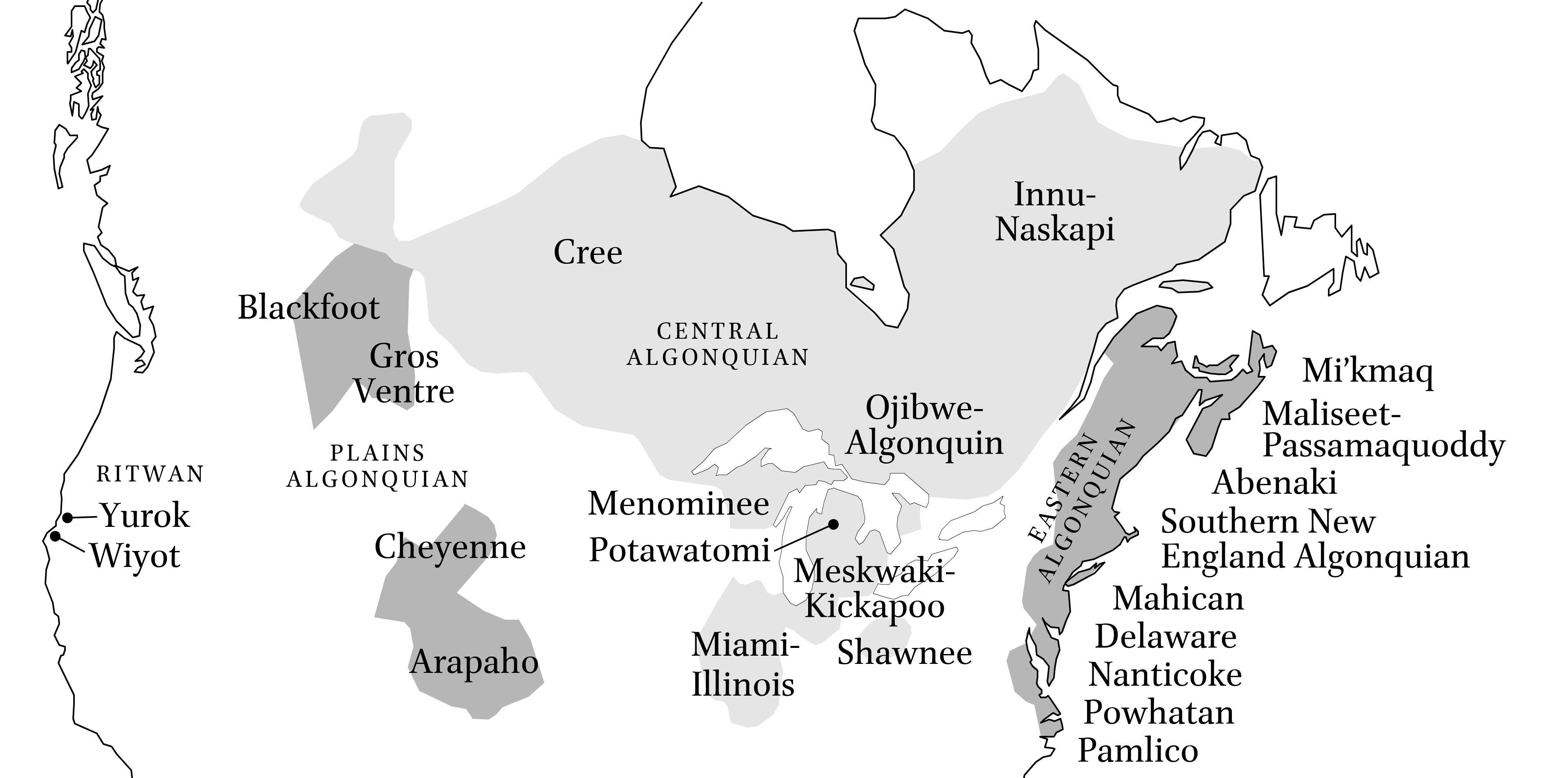
Algic family
Drawn by Will Oxford. To appear in Oxford in press. Language locations based on Goddard 1999.
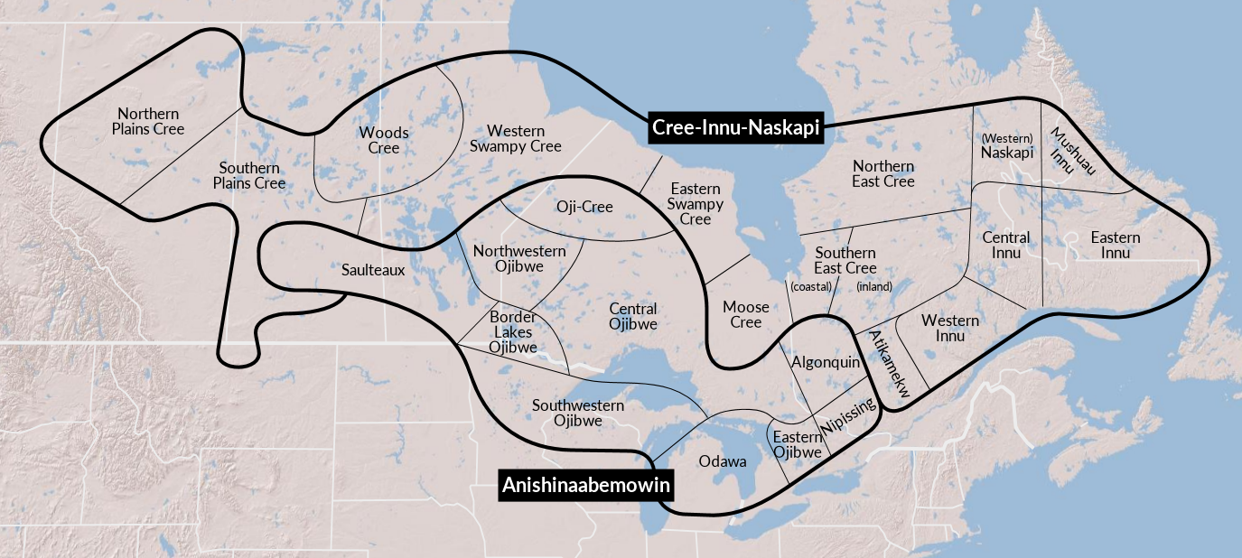
Cree-Innu-Naskapi and Anishinaabemowin varieties
Drawn by Will Oxford in schematic style for legibility; precise locations of borders should not be taken literally. Classification of Cree-Innu-Naskapi dialects based on Rhodes and Todd 1981: 53 and Cenerini, Junker, and Rosen 2017: 308. Classification of Anishinaabemowin dialects based on Rhodes and Todd 1981: 54, Valentine 2001: 14-17, and Rhodes 2020: 563. Background map image from National Geographic MapMaker.
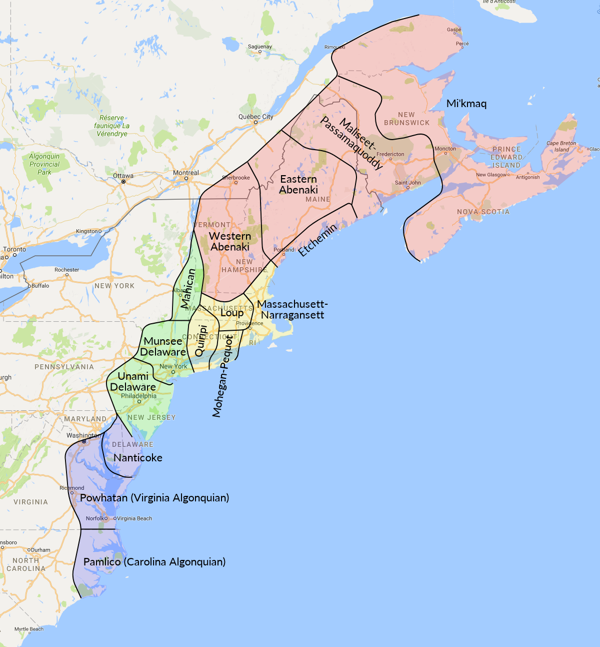
Eastern Algonquian languages
Drawn by Will Oxford. Language locations based on Goddard 1999. Background map image from Google Maps.
Key to colours: red = Northeastern languages; yellow = Southern New England languages; green = Delawaran languages; blue = Southern languages (geographic grouping).