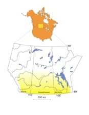
Despite inherent difficulties and limitations in applying large-scale GCM simulations to relatively small scale and more local investigations (Barrow, 2001, 2004; Barrow and Yu, 2006), a large body of research suggests that projected warming in western Canada will adversely affect water quantity, which will ultimately lead to water quality problems (Demuth and Pietroniro, 2003; Lemmen and Warren, 2004; Maathuis and Thorleifson, 2000; Schindler, 2005; Schindler and Donahue, 2006). Clearly, future water availability and drought frequency/duration are exceedingly important topics in terms of the agricultural production and economics of western Canada, and therefore have received much attention from government agencies and academic researchers (e.g., Lemmen and Warren, 2004; Sauchyn et al., 2003; Sauchyn et al., 2002). In contrast, there has been surprisingly little research on adaptations to climate change impacts on the ecosystem resources of western Canadian lakes (Melville, 2001). Today, this Prairie region contains literally millions of lakes and wetlands (Adams, 1988; Gollop, 1963; Last, 1989, 1992a), which serve a critical role in waterfowl and wildlife habitat, recreation, and an array of economic and social pursuits. The vast majority of these lakes occupy small closed basins (Hammer, 1984; Last and Ginn, 2005) that respond dramatically to changes in climate, groundwater, and drainage basin and landscape modifications.
As noted on the Welcome page, receding lake levels in the Prairies are a problem, no doubt made more noticeable by the fact that the lakes in this relatively dry region of Canada are heavily used for recreation, agriculture, and industry. Although few historical records extend back more than just a few decades, it is clear that the general trend within the Canadian Great Plains over the past ~40 years is toward lower lake levels (Evans et al., 2006; Van der Kamp et al., 2007). Similarly, in the shorter-term, 70% of the lakes in the Great Plains region of Alberta that are monitored by Alberta Environment have had mainly below normal levels for the past five years (Alberta, 2007). These declining lake levels present a multitude of associated environmental concerns due to increased salinity and changes in biogeochemical processes dominant in the basins (Evans and Prepas, 1996; Last, 1992a).
Although declining water levels are noteworthy, it is also evident the entire Great Plains region cannot currently be characterized by diminishing lake levels. Since the 1990’s, many lakes located in broad areas of the northern Great Plains have experienced exceptionally high stands (e.g., Johnson et al., 1999; Shapley et al., 2005; USGS, 2006; Winter and Rosenberry, 1998). When high lake levels occur in closed basins the immediate and long term repercussions can be just as devastating to the local communities and economy as low water levels (e.g., significant property damage, road closures, demolition of homes and other structures, loss of agricultural land, controversial large-scale dyke and water diversion projects, etc.)(Arroyo, 2006; Owen, 2007; Wallace, 2007a, b).
Any strategy for water resources management in this region, either for quality or quantity purposes, must recognize and accommodate large variances imposed by natural fluctuations and trends over the longer term, and episodic drought and flooding caused by anthropogenic stresses over the short term (Harrington et al., 1997). Effective management at the local and regional levels requires not only collaboration among agriculturalists, developers, industrialists, outdoor enthusiasts, and environmentalists, but most importantly a scientific knowledge base and a sound understanding of the impact of climate change on lacustrine and wetland hydrology of the prairies. Unfortunately, with a few notable exceptions (e.g., Conly and van der Kamp, 2001; Covich et al., 1997; Last and Teller, 2004; Michels et al., 2007; Patoine and Leavitt, 2006) very little is known about natural long term hydrological changes in most areas of the Canadian Great Plains. This paucity of data and conceptual framework greatly limits our ability to accurately predict the influence of projected climatic fluctuations in the longer term and the effect of anthropogenic (cultural) stresses over the short term.
In the absence of extended historical records for most of the lakes in western Canada, these hydrologic perturbations are most efficiently examined using the geochronological record from the sedimentary deposits of the basins. Paleoenvironmental analyses are required to generate a scientifically-defensible analysis of the role of climate and natural variability versus human induced fluctuations. Physical, geochemical, and biological components of lake sediments provide an archive of vast amounts of detailed information about past changes in hydrology, climate and ecological conditions (e.g., Clark et al., 2002; Evans, 1993; Fritz et al., 2000; Hall et al., 1999; Last and Slezak, 1988; PARC, 2003; Sauchyn, 1997; Smol, 2002). The challenge is to identify the lake basins that contain the most informative sediment records, analyze these sedimentary deposits at the finest temporal resolution possible and select the paleoenvironmental indicators that are most sensitive to hydrological and climatic changes.
In the context of the northern Great Plains, it is evident from previous research that the complex dynamics of large open-drainage lakes (e.g., Lake Manitoba, Lake Winnipeg, Lake Winnipegosis) make them less desirable sites for paleoenvironmental analyses. In these large open systems with very large catchments, water levels are controlled by the complex interaction of tectonics, basin sedimentology, drainage basin changes, as well as climate (Henderson and Last, 1998; Last, 1996; Last and Teller, 1983; Last et al., 1994; Lewis et al., 2001; Risberg et al., 1999a; Teller and Last, 1981; Todd et al., 1998). Similarly, playas and other episodically dry wetland basins, which comprise the greatest proportion of lacustrine environments in the Great Plains, present difficulties because high-discharge events as well as extended dry episodes can remove sedimentary records (Last, 1992b, 1994). These attributes make it difficult to establish a continuous and accurate chronology.
In contrast, the best sites for reconstructing the history of hydrologic and climatic change in the Canadian Great Plains are the relatively small but perennial closed-drainage lakes. These lakes are highly sensitive to changes in their water, sediment and nutrient balances and therefore their deposits are much more likely to provide an unambiguous record of past hydrologic and climatic fluctuation. The regional abundance of these closed-basin lakes in the Great Plains and the general scarcity of other paleoenvironmental indicators such as tree rings, ice cores, etc., dictates that the lacustrine records in many parts of the region provide the only basis of both short term as well as long term climatic fluctuations. As shown in many other paleolimnological studies elsewhere (e.g., southwestern United States, Africa, China, Australia), investigation of both the physical and chemical components of the lacustrine deposits can lead to important conclusions regarding paleoenvironmental conditions of the basin. Richardson (1969) long ago pointed out that shallow closed lakes (as opposed to deep closed lakes) offer a more detailed record of climatic fluctuations; however, the shallow lakes are also more likely to contain significant gaps in their sedimentary sequences.