Site Retirement Notice:
Since the early 1990s I have taken advantage of the personal web hosting at the UofM as part of my employment. Now, after many years, I will be retiring. This means that these web pages will also be retired at the end of the summer 2024.
Some of the information will be moving to: https://sites.google.com/view/charlesburchillhome/charles-burchill-home/canoeing/winnipeg-canoe-access-points
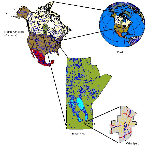
Winnipeg
Canoe Destinations and Access Points

Over the years of organizing open paddles for Paddle
Manitoba one of the most common questions from participants has been:
"where can I go paddling"? The answer to this question usually starts
with me asking even more questions to figure out what kind of
paddling, how far, trip interest, and skill level. Usually people
that come out to open paddles, and ask about destinations, are looking
for easy day trips or just an afternoon paddle. This page was setup
for those people interested in a quick local paddle; if you are
interested in longer trips or something a little further afield there
are a number of other resources
available.
Since I live in
Winnipeg I have spent some time paddling the local rivers and
creeks looking for places to get on and off the water. The following
list includes the larger rivers, creeks, and some ponds, in Winnipeg
which usually have at least some navigable sections for extended
periods each year. The map to the right should be interactive
allowing you to zoom into different areas across Winnipeg showing
locations that I have stopped at over the years. The points with an
arrow are the locations that I have used more often. The approximate
distance between the river points has been provided for each river
below. It is possible to paddle both up & down stream from most of the
put in points that I have identified. Traveling upstream (against the
current) can take several times longer than the same distance
downstream, take this into acount. Tear drops indicate ponds that I
have checked out.
Only a few of the sites have docks or boat ramps, the
City Winnipeg maintains a list of dock
and boat launch locations on their website with more information.
Most of the other sites listed here are just a river bank with some kind of
access. In most cases the access is easy with only a short
walk. A few of the locations may have more difficult shorelines or
river banks to climb down. The shorelines of the rivers, especially
the Red, are often muddy making access to the water difficult.
Typical of many prairie rivers the levels get lower throughout the
summer providing some challenges for late summer and fall
outings. This list is certainly not exhaustive and I certainly have
not found all of the access points, there are still other locations
such as Bun's Creek and Omand's creek along with many retention ponds
that can still be paddled at some times of the year.
I visited all of these sites during the summer and fall
(August-October) of 2009, not always from a canoe, to confirm there was
still access the river from the shore. I have also canoed to or
from or past all of these places sometime over the last 30 years.
Access to the rivers is surprisingly dynamic depending on the season
and water levels. There have also been quite a number of changes over the
years due to zoning or building, the river bed itself has even changed in
a few places. I discovered a number of places this fall (2009) that I had
used in the past that were now either fenced or marked as private
property. A few additional places the river bank had collapsed so it
was no longer suitable for reaching the water. On the other hand in
my explorations to check old sites I found a number of new ones that I
did not know existed.
If you want to get out for a paddle on the rivers, creeks, or
ponds around Winnipeg please remember to bring the appropriate safety
equipment, wear a PFD, tell someone where and when you are going,
and take careful note of the water conditions
in light of your skills. Care must be taken when approaching the river as
the river bank may be unstable or collapse - this is particularly true when
the water is high or where there is a drop-off to the water. Check with the
City of Winnipeg
River Patrol to see if there are restrictions
or notices on use of the river. When heading down to the water please
respect private property and remember conditions as well as
access might change over time. If you drive remember to check for
appropriate parking or your car may be towed or ticketed.
If I have missed your favourite launching spot please let me know so
I can check it out and add it to the list.
La Salle River
The headwaters of this little river are found near Portage la
Prairie; it meanders across the prairie until it eventually passes
through the town of La Salle and finally into the Red River near the
floodway control structure south of St. Norbert. At La Barriere park
there is a dam and further upstream, near the town of La Salle, there is a
large riffle structure both of which keep the water level deep
enough for an enjoyable paddle over the summer. Typically the
river is slow moving (really a long skinny pond) for much of the
summer but don't be fooled after heavy rain and in the spring
there can be a considerable current.
Put in locations:
- St. Norbert (north west side of Pembina Hwy bridge, park on Eglise Ave). There is
a nice easy place to drop a canoe into the river under the bridge. There is a lot of
stabilized riprap (or rough stone/brick work) that makes for good footing. There
is usually a lot of broken glass so be careful.
- Rue Des Ruines (Monastery Ruins). North of the parking lot is where
I have launched in the past but with changes at the Monastery things might be different now. Stop and visit the Arts Centre or spend some time in contemplation.
- La Barriere Park (5km south of the Perimeter hwy on Waverley). This is a very popular
place for going out on an evening or afternoon paddle.
Most evenings and weekends there is a good
chance that you will meet other people paddling. This is the location that
Paddle
Manitoba runs Wednesday evening paddles. Paddling up stream is always possible, down
stream gets a little dicey (if possible at all) later in the summer when the river is low.
At various times, usually in the spring or after heavy rain, the dam and the bridge are
often underwater - there may be strong currents and a drop over the dam at these times.
-
Four Mile Rd, bridge west of River Oaks golf course
- Town of La Salle (just to the west of rail lines, turn north off of 1st
onto Desgagne). Paddling west from this point takes you past the town on the south side of the river
then past Kingswood Golf and Country Club and beyond.
- Town of La Salle off of Vouriot (North east side of La Salle off of River
Wood Dr- by the foot bridge). This is a very pretty little park with a
wonderful footbridge across the river. Just down stream is a
fairly large riffle structure - be careful of currents and the
associated drop when the water is even a little high.
Note: In August-September the low side of the dam near La Barriere
park is usually too shallow to paddle.
Distance Between La Salle River Points
| La Salle | Four Mile Rd | La Barriere | St Norbert | Red River
|
| La Salle | 0 | 5.2 | 9.7 | 16.5 | 18.4
|
| Four Mile Rd | | 0 | 4.5 | 11.3 | 13.2
|
| La Barriere | | | 0 | 6.8 | 8.7
|
| St Norbert | | | | 0 | 1.9
|
| Red River | | | | | 0
|
Obstacles:
- Dam at La Barriere Park. After heavy rain or in the spring there may be a strong current with a substantial drop over the dam.
- Quick water at the TransCanada gas pipe line crossing (near end of
Camp Amisk) ~3km east of La Barriere.
- Riffle structure in the town of La Salle (east of pedestrian
bridge).
- Watch for people fishing above and below dam at La Barriere.
- The river can be very shallow from La Barriere park to just upstream of the Monastery through
the late summer and fall.
Further afield:
You can start at Elie and paddle into Winnipeg. Elie to
Starbuck is 33km as the river flows. Downstream of the
Elie dam, for about 8km, be prepared for many downed
trees and toe dabs. The distance between Starbuck and
Sanford is ~23km; Sanford to La Salle is about 30km.
There are lots of bridges providing alternative egress
sites. It is a nice quite little river - further out be
prepared for fallen trees blocking the channel of the
river. There are several riffle structures (Starbuck/La
Salle), a low head dam (between Starbuck and Sanford),
and two regular dams (Elie/Sandford). There is very
little current except in the spring and after heavy
rain. It is possible to paddle further upstream from
Elie as well, the dam helps, but the river starts to get
pretty small.
Seine River
This beautiful little river, with head waters in the Sandilands
south east of Steinbach, runs through the heart of St. Vital and
St. Boniface. Later in the summer, except after heavy rains, it
is usually too shallow to paddle comfortably but in the spring
and early summer it is worth spending some time on this jewel.
The river is fairly narrow and even small fallen trees can block
the way so be prepared to step out occasionally or bring a hand
saw. There are lots of access points, unfortunately it is
sometimes a little difficult to distinguish between private and
public property, if you are uncertain about the access try a
different location. A good source of information on the river
within Winnipeg is the Seine
River Greenway map (note: the online map is no longer available) created by Save our Seine River
Environment Inc. Steve Lambert maintains an interesting
site about
paddling the Seine that is well worth a visit
Put in locations:
- Prairie Grove Road (south of Perimeter hwy) or
Willow Grove Road.
-
Sumka Road (next to Perimeter hwy)
-
Creek Bend Rd.. With recent building
access is no longer as easy and parking is more
problematic.
- Behind the French School division office (1095 St Anne's Rd) just south of Warde there is access to the
river. Parking will be an issue during the week.
-
Shorehill Dr. Access the river from the parking lot of Morrow Gospel Church.
During some times of the week you will not be able
to use or access the river from the parking lot. This spot will get you above the
riffle structure under the Shorehill Drive bridge.
- John Bruce Road Putting in at this foot
bridge to paddle south to Shorehill drive (and
further) is one of my favourite city paddles; just
like being out in the wilds with out the long drive.
The river bank is starting to see a lot of building
on the west bank which is unfortunate, let's hope
that the current look is temporary and the new
owners respect the river.
- At the intersection of Aubin and Orchard Hill drive there is a
cut through to the park. Just to the south there are trails
that allow you access to the river.
- At Willowlake and Southbridge there is a small pond with a
channel to the Seine. Access is good but the channel may get
too narrow or shallow at some times of the year.
- Worthington Ave. Right off the end of the street
is a small woodland. Like many other places this area
might appear like private property but it is OK for
now. This connects up with the woodland on Hindley but
the path there now (Oct 2009) has a for sale sign
suggesting it is not suitable for access.
- Southbridge Drive, north of Willowlake, there is a
small park with access down to the river where
there is a storm drain.
- Berrydale. Path off of the end of the street down
to the river. About 100m down to the river. There is
also an open space where telephone lines go under the
river at Sadler Ave but that is a steep[ish] climb.
There is a sign posted here about how the area was a
litter pile and who cleaned it up.
- Clayton near Wingham. Nice little park with a good
path down to the river and reasonable launching
location.
-
Niakwa Road (East side near golf course entrance).
From here to the Red (Nadeau) is the section I paddle most often. It wanders
through a couple of golf courses, pretty
forest, and quiet residential areas.
- Comanche Rd. Walk down the path to the river for access below the
shallow spot under the Fermor bridge.
- Egerton just north of Humboldt. There is a small wooded area
with a number of paths down to the river. The best access is the
straight path closer to Humboldt.
- Blenheim and Egerton. There is a path down to the river right in the
corner of the two streets.
- Morier Park (near Egerton & Morier). This is a pleasant
little park to stop and have a picnic when out for an
afternoon jaunt. There are a couple of routes down to the river,
the one to the south is shorter and more direct.
- Guay just off of Youville.
- Evans St. near Gareau (behind the community center).
- Evans St. at Cusson. There is access down the bank even though
it is a little steep. Dropin below the 'rapids'.
- Dubuc St. You can walk down to the river in several places
east of Seine St.
- Edgewood St or Tremblay. There is a walking bridge across the river here. The best
access is from the west (Edgewood) but both sides will work to get down to the
river.
- South side of Happyland park. Take this chance to stop and do a round of
Rrisbee golf.
- North end of Youville
- Gabrielle Roy Park
- Nadeau (north of Provoncher). Probably because of long habits
this is usually where I pull out my canoe most often. If the
dock is in at Lagimodiere-Gaboury that maybe a better location.
If the dock is out this is a much better shoreline to avoid the
mud.
- Lagimodiere-Gaboury Park This is a pleasant park
with good access and a nice waterfront/dock. Use
this location to get
onto either the Seine or for a hop off point to the Red.
Note: Much of the Seine River goes through golf courses. Watch for
flying balls and, sometimes, golf clubs. Right before
Provencher the river is usually very shallow. For many years
there has been a narrow spot with quick currents and a drop
just upstream of Gabrielle Roy Park. A little further, past
the rail bridge, there was an extensive, and badly needed,
remediation project to clean up the old IKO site, the river
was closed over the fall of 2009 at this location.
The river was opened again in 2010 but it looks
a little like a moon scape; a lot of replanting and
landscaping has been done so it will be very nice once it fills in.
Distance Between Seine River Points
| Prairie
Grove | Creek Bend | Shorehill | John Bruce | Niakwa | Lagimodiere-
Gaboury | Red River
|
| Prairie Grove | 0 | 3.6 | 6.2 | 8.9 | 16.2 | 25.7 | 26.3
|
| Creek Bend | | 0 | 2.6 | 5.3 | 12.6 | 22.1 | 22.7
|
| Shorehill | | | 0 | 2.7 | 10.0 | 19.5 | 20.1
|
| John Bruce | | | | 0 | 7.3 | 16.8 | 17.4
|
| Niakwa | | | | | 0 | 9.5 | 10.1
|
| Lagimodiere-Gaboury | | | | | | 0 | 0.6
|
| Red River | | | | | | | 0
|
Obstacles:
- Fallen trees at any time of the year.
- A lot of junk has been thrown in the river (although SOS has done a
good job cleaning up). Watch for concrete blocks with rebar and
other similar things that can damage a canoe.
- Beaver dams are fairly common along much of
the river from Morier Park south.
- Riffle structure near Shorehill drive
- Narrow passage south of John Bruce
- There is a homemade 'bridge' or walk-way across the river
between Shorehill and John Bruce
- Swift current under Fermor Ave
- Culverts in Windsor park golf course (usually a portage is required but in low water
you can go through).
- Riffle structure between Marion and Provencher.
Further afield:
The above sites are all downstream of the Red River Floodway Siphon - a U
shaped pipe that carries water under the diversion. It is a
significant portage (not long just annoying) to cross the diversion
and get back to the original river course. You can start outside the
city at the end of Carriere Rd and paddle through Grand Pointe, Lorrette,
and points beyond (Dufresne, St. Anne, ...). You must portage
over hwy 59 and there are often many blockages (e.g. downed trees)
elsewhere. Some sections
unfortunately have been straightened and have the feeling of a big
ditch. Further out it becomes quite a small river. Although I have only
paddled
as far out as Lorrette I expect that it becomes problematic to
navigate later in the spring and summer as the water levels go down.
Assiniboine River
With headwaters in Saskatchewan the Assiniboine River wanders across
the prairies for over 1000km before entering Winnipeg from the
west. The river provides an excellent opportunity for touring Winnipeg
from the other side of the bank. It is usually too shallow west of
the Maryland Street bridge for larger and even some medium sized boats
giving paddlers a chance to explore and experience Winnipeg's second
largest river without competing with much boat traffic. Paddling from
Headingley to the Forks (Red River) is a ~4 hour enjoyable paddle. If
you are not into this distance don't fret there is ample opportunity
for shorter paddles. Be aware that the current on the Assiniboine is
quite fast in places and returning against the current can often take
two or three times the amount of time it took going out with the
current. In many places the river is very shallow, especially from
mid-summer through the fall, which also makes a return trip tricky and
slow. If you enjoy poling there are a number of sections where you
can practice (e.g. St. Charles to Lanoo and west of Assiniboine Park).
Put in locations:
-
Beaudry Park. I drop my canoe in here when I want something a
little further out. The paddle from
here to Headingley is about one hour. When I come here I now start at the Oak trail
since the bank near the Grape trail (large parking lot) is
unstable. Remember this is a provincial park you will require a
Provincial Park pass.
-
South Headingley - Roblin Blvd & Rodney St. There is
a small parking lot here and good access to the river
with gravel bank. I have often paddled from
Beaudry park (even further west) to this location.
- Roblin Blvd & Hall Rd (follow trail east of drainage ditch)
-
Oxbow Bend Rd (gravel side road next to Perimeter hwy, access
from Augier Rd.). This has
been a drop off point to paddle home (Ft. Garry) for many
years. Recently with the housing developments a little further
east I have been starting further out (near Headingley) or
closer at St. Charles. The paddle from here to the Forks is roughly
2.5 hours, with an additional 2 hours up the Red to the
Wildwood Golf Club.
- St. Charles Street
-
Coleridge Park. Great access - a nice little park with benches
and a stone path and stairs to follow. There are some larger stones at
the north end of the park that make for a good landing.
- Several Access points off of Assiniboine between
Coleridge and Westwood - Bedson, Rouge, Westwood. The
shoreline at these points drops down to the river
so you might want to use Coleridge instead. In the
1940 & 50s the site at Rouge was a
swimming hole called Westwood Beach.
- Southboine Canoe Launch (Southboine and Paradise). This is a straight
simple path with a good bank for putting a canoe or kayak in the water.
- Lanoo Dr (near first corner, hard to tell where park ends
and private property begins).
- Woodbridge Rd (Near Assiniboine Cres - beside
pedestrian bridge over Sturgeon Creek). This is another
spot that I often use as a drop off/pick up location
when paddling either Sturgeon creek or the Assiniboine.
You can also launch from below the Moray street bridge (west
side) but this is easier and nicer.
- Smithdale park near Vialoux and Hendon Ave
- Kenaston Blvd. Below the bridge on both the north and
south shores of the river there is reasonable access.
The current can be alittle fast on the south shore and
the water quite shallow from the north.
- Assiniboine Park (East). There is a put in just above the
faster/shallow water near the east end of the park - near where
the road turns away and many people picnic. There is
quite a steep/high bank but there are several trails down
that should be easy to navigate. There are several very
nice picnic locations near here.
-
Assiniboine Park bridge (North west side). I usually park
on Deer Lodge Place but in the park also works. I have
often paddled with family friends making a stop here
for a picnic, a sundae (across Portage), head off to the
zoo, or just use the washroom near the duck pond. There
is a little island just up stream on the north side
that has 'rapids' one the narrow side. You can paddle
through the narrow channel and back around for some fun.
- Wellington and Doncaster. There is a storm drain just below
this interesection (south side of the clearing). It looks
like there is a big difficult hill to climb but there are
trails down from either side that are fairly straight forward
to walk down.
- Bruce Park. It is possible to climb down the bank on the east
side of the creek. If you have come this far you are probably
better off going a little further to Assiniboine Park or Ferry.
-
Bourkevale Park (near Ferry Rd. and Assiniboine Ave.). Near
here is a free roam dog park so expect a few fury
visitors as you try to get in and out of your boat.
- Near Wellington and Renfrew. Park
near the tennis courts and walk down to the river across the
park. There is a climb required to get down to the river
often with broken glass - it might be easier for the
faint of heart to pick another location such as
Omand's creek across the river. Below the rail bridge
there is usually enough current (dare I say little rapids) to get
warmed up for some moving water.
- Omand Park (access from east side). I usually park on
Raglan Rd. Paddling under the rail bridge is a good
moving water warm-up. This is another nice location to drop
in for a short paddle down to the forks (~1 hour).
- Wolseley near Telfer or Clifton. This is a nice little park with
reasonable access. Getting down the bank can be a bit of
a scramble.
- Dominion St. There is a small park right at the end of Dominion
street that provides access down to the river.
- Palmerston Ave & Aubrey. The 'bridge' here is not really
a bridge but a pipe crossing the river. Access is
relatively easy and the shoreline makes it easy
to launch a canoe.
- Arlington and Palmerston. There is a nice little walk with stairs
down to the river. It is a little narrow but that is made up
for by the quality of the access point.
- Palmerston & Canora. Some of my family live near here and
I have been caught walking my 16 foot friend across both
Wolsely and Westminster more than once. Not the easiest
place to put a canoe into the water but it works.
- Middle Gate. The last time I was here it was pretty
over grown but there still was a narrow trail surrounded
by large burdock plants.
- E. Gate and Blanchard. This is another nice little park with a
path and benches. Access is not that bad but it can be a
scramble and the bank can be alittle muddy.
- Hugo St. I have been picked up here on a number of occasions.
Unfortunately it has often been after a peak in the water level
and the steps/launch have been muddy - really it is a
nice place. I have dropped in here on a couple of occasions to paddle
down and watch fireworks from the river near the Forks.
- Cornish. Another water pump station that is also the start (end)
of a bicycle path that continues along the Assiniboine to the
Forks.
- Mostyn Park (Spence) or Mostyn Place Park (near Osborne). Look for
the information on the old postal building that stood near this
location.
- Near Legislative Bldg. Good luck with parking...
- Fort Rouge Park (River and Cauchon). This is a nice park with a
fun water (spray) park. Go past the water park and down
the hill along the pea gravel trail. A couple of years ago
there was some significant river bank stabilization done
so there is a lot of riprap for launching a canoe. I noticed a
lot of broken glass last time I was here.
- Near Garry St. Again parking is an issue especially during the week.
-
The Forks The destination, or just a stop off, from
the North, South, West, and East (Seine). I have fond memories
of meeting my family for lunch either at a hotdog vendor or
something a little more formal. If I am picking up or dropping
off I tend to go around to Provencher since parking & crowds
are often a problem at the Marina.
Distances Between Assiniboine River Points
| Beaudry
Park | Headingley | Oxbow Bend | Coleridge | Woodbridge | Assiniboine
Park | Ferry Road | Omand's
Creek | Forks
|
| Beaudry Park | 0 | 6.4 | 14.2 | 15.4 | 20.4 | 23.1 | 24.1 | 26.4 | 32.1
|
| Headingly | | 0 | 7.8 | 9.0 | 14.0 | 16.7 | 17.7 | 20.0 | 25.7
|
| Oxbow Bend | | | 0 | 1.2 | 6.2 | 8.9 | 9.9 | 12.2 | 17.9
|
| Coleridge | | | | 0 | 5.0 | 7.7 | 8.7 | 11.0 | 16.7
|
| Woodbridge | | | | | 0 | 2.7 | 3.7 | 6.0 | 11.7
|
| Assiniboine Park | | | | | | 0 | 1.0 | 3.3 | 9.0
|
| Ferry Road | | | | | | | 0 | 2.3 | 8.0
|
| Omand's Creek | | | | | | | | 0 | 5.7
|
| Forks | | | | | | | | | 0
|
Obstacles:
- West of Morey Street (Charleswood bridge) it is shallow with potential for quick currents and small rapids
- West of the Assiniboine Park bridge it is shallow with some quick currents or small rapids
- Kenaston Bridge (just west of) to Omand's Park there is swift current
with small rapids.
- East of the Maryland Street bridge there may be larger boats.
- Watch for boats and personal watercraft around the forks.
- Remember the current is faster than you might think - going back is slow.
Further afield:
It is roughly 100km from Portage la Prairie to Winnipeg (Hwy
248 to Beaudry park is 50km). When the current is running
the Portage trip can be done in a couple of long days. There are not
many places to stay so check ahead. There are (were) camping
locations where the river crosses the Trans Canada near Portage and
again near Winnipeg. There is also one possible site about half way
but I have not stayed there, or contacted them, so you will need to
check yourself. There are many egress points as well so bring a cell
phone and have someone pick you up.
Red River
The Red is the largest river in Winnipeg. In the spring the
current can be quite strong, the river is fairly wide making the
strength and speed of the current deceptive. Later in the year the
water level is basically controlled by the St. Andrews dam at Lockport (yes that is a long
distance from Winnipeg) and the current is not nearly as strong. The
river is remarkably flat with only a slight drop (1:5000) across the
whole length and even less in Manitoba (
1:10000 also Statistics Canada Report) where it traverses the bed of glacial Lake
Agassiz. When the river breaches its bank it basically fills the
bottom of this ancient lake creating in some years (1997 for example)
what is locally known as the Red Sea. In the fall the river is drawn
down (dam at Lockport pulled up) at this time there may be some
extra current but getting to the river across the muddy bank is probably
a greater problem. The city also pulls out their docks at the same time.
There can be a fair bit of boat traffic on the Red especially
around the Forks and further north. There are a few larger boats, such
as the M.S. River Rouge, M.S. Paddlewheel Queen and Princess, along
with many intermediate sized pleasure boats. You can sometimes meet
water skiers coming down the river which always makes me a little
nervous. I have seen many personal watercraft zooming around near the
forks and as far north as the Perimeter hwy. There is less boat
traffic in the south end of Winnipeg - I have often wondered if the
speed limits around the rowing club, MPA, and Churchill marina have a
chilling effect on boaters. I must admit I don't find the paddle along
the Red as nice as the other rivers due to the size and increased boat
traffic. On the other hand it is an easy portage from my house so I
do paddle a fair bit near Fort Garry.
Put in Locations:
- La Salle River, St. Norbert (see above). It is also possible to access the river from St. Norbert Heritage Park but that involves a tricky climb.
- Below Floodway control structure (Turnbull or Courchaine) - watch out for current and eddies from the floodway control structure. Launch well below and away from the control structure. With the floodway expansion project it may not be possible to access the river off of either Turnbull or Courchaine.
- Cloutier Dr (below Perimeter Hwy bridge). This is not the best
location for launching - it is often muddy and has many willows.
If you want to explore a little further
upstream there is a 'creek' or out-flow from the Ft. Richmond retention ponds
that provides access. It has been many years since
I have used this point but it should still be there. The last
time I went by this point there were 'Private Property', 'No
Trespassing' signs at this location. It was not clear if this
applied to the land on one side (or other) or to the outflow.
I am not sure how it could apply to the outflow as access
is required for maintenance - if the area is signed please
respect private property.
- Kilkenny drive (Opposite Linacre Rd, North of Radcliffe).
I bought my first canoe when I was 15 years old and walked down
here to paddle almost every day during
the summer. There is nothing quite like owning a
boat that you can carry down to the water and then paddle away for
a quiet afternoon or evening. The city changed the outflow
for the storm drain so it is not quite as nice for launching
now but it still works well.
- Kings Park. The best access point is west of the main parking lot. There is a clear
dirt/mud
path that may involve a little scrambling. Sometime in 2014
extensive shoreline remediation was completed here and the
bank is not currently suitable for acccess due to large/loose
rock. Further south there is another access
point where the pond drains into the river.
It involves a short portage. At one time there was an
access point right
off of the end of Kings drive but I don't know if that
is still possible. On the east side of the park, opposite
the water fall on the hill, there is a water
in-take that provides access. Long ago
I would also follow the path near Parkwood Place
(north side of the park) down to the river
- it was never a very good place
and I usually had to search for a downed tree to help
climb over the mud to the water.
- Maple Grove Park. Near the gates is a boat launch.
- Redview Dr. There is a cut through between the houses that provides access to the park. There is a
fair hill to climb down and the shore is pretty muddy at times.
- UofM near Maclean Cres and Freedman Cres. It has been a long
time but there was a storm drain outlet that was easy to use.
Like the Kilkenny drain this was a favourite access point
throughout my teenage years.
- Behind the UofM Geological Sciences Building (near Sifton Rd & Dysart Rd).
There is also a place to launch across from the Science library and
down from the Law building (by the Castle). Daytime parking during the week
will be a problem.
- River Road park. Opposite Minnetonka you can access the river. There is a warning
sign about the bank being unstable. Further west there is a river stabilization
experiment/project.
- River Pointe Dr. There is a nice walk through with some historical information
off of the drive. Straight down the hill from the cut through there is river access
that, at times, can be muddy but otherwise fairly nice.
- You can launch below the Bishop Grandin bridge on both sides of the
river. Access is good with rocky shore. Near the west side there is a
large storm drain outflow that provides a good launching spot. Try parking on D'Arcy (west) or
Blackmore (east). A little further south on D'Arcy,
near the golf course, is another excellent place to launch
where there has been a bunch of bank stabilization.
- There is a large dock behind the Pony Corral on Pembina. This is private parking and
access but if you eat at the restaurant you may be forgiven.
- Crescent Drive (just east of South Dr) there is reasonable access. Given the number of
fish bait containers I saw last time I was there it is looks like a fishing hole as well.
- St. Vital Park (boat launch). Good parking, easy access, good launch conditions.
- Moore Ave (off of River Road). There is a large water pump/outflow with nice access and
good shore (riprap) for launching a canoe.
- Crescent Drive Park (old boat launch near north end of the park). The boat launch
is no longer serviced or available but for canoes it is useful. Parking may be
a bit of an issue now.
- Harris Park has a nice path down to the river. You can park on Salme Drive.
- Kingston Cres. at Riverdale (south side of point). Opposite the Elm Park bridge is a
storm drain control structure that provides good access to the river. There
is no access on this side (Kingston Cres) of the Elm park bridge.
- End of Sommerset Ave (behind Wildwood Golf Club building).
When I lived in Ft. Garry this was a regular jump
off or landing point for trips on the Red and Assiniboine.
The storm drain provides
a wonderful dock for most of the summer and fall.
- Toilers Park (near Byng & Riverside drive). A few years ago the neighbours
put in tons of riprap to stabilize the bank which made access easier. During the summer of 2014 there was a significant amount of work and shore
line remediation being done which may change access.
This park was, at one time,
the outflow of an intermittent creek that ran through north Ft. Garry, there was a dock
nearby and a swimming hole. When you arrive take a look at the plaque and learn
a little about the Toilers basketball team.
- Jubilee Ave at Riverdale (Stop for Ice Cream at BDI). It works but
I have to admit the real reason that I use this spot is for
a Goog Special. It is not great for
launching since parking can be a problem and the shore is not
always good for landing. A few years ago BDI had a floating dock
but they appear to have abandon that attempt, but there is always hope that it will be back.
- Kingston Row (near Killarney St) & below Dunkirk Bridge
- Churchill Drive Park (near Osborne much of the rest
of the bank is too high). Parking is an issue close to the bridge.
- Mager Dr off of St. Mary's. A parking lot with gravel path down to the river - what could be better.
- Guay Park. This is not a great place to launch a canoe
since the bank is high, there is a drop off, and parking
can be a problem, but I have gotten in and out here a few
times for various reasons. I have added this point mostly
from memories of the place that got me into my own boat....
Back in the 1970s I bought my first canoe,
and other camping equipment, across the street at The
Happy Outdoorsman (433 St. Mary's). There is a bike store there now
that I visit almost as often as I did the outdoor
store.
- Lyndale Drive Park. Near the south east end, near Claremont or Chandos, there are
stairs and/or a ramp otherwise it is a steep climb.
-
Churchill Drive near Hay street
Manitoba Paddling Association
(just east of Hay) has a building and a dock that I have used
in the past. If you arrive and there are paddlers out on the river
or using the dock please be patient and wait until they are finished or clear
of the dock.
- You might be able to put in at the Winnipeg Rowing Club (Lyndale Dr).
It is a private dock so you must get permission first. There is access
further upstream between Highfield St. & Blasam Pl. It is an old culvert that is often under water; it is also an annoying climb.
-
The Forks There are lots of places to put in/take out.
I usually park and put in near Provencher Bridge but that may no longer be as
easy with the completion of the Canadian Museum for Human Rights. Stop at the port, lock up your
boat and go for lunch/supper. I have taken (portaged) my boat up a
few times and eaten on one of the patio's leaving my boat
within arms reach.
- Tache (between St. B. Hospital and Provencher) is a city dock.
- Tache at La Verendrey. There is a pumping station with a really nice rocky bank.
- Whittier Park (near Fort Gibraltar). Park near the toboggan slide
follow the path down to the river. There is a dock or at least
reasonable launching point. Sometimes it is good, sometimes
not so good.
- Seine River (see above
Lagimodiere-Gaboury Park)
- Louise Bridge - either end. There is a city dock at the south east
end of the bridge.
- St John's Park (Near St. Cross). There is a nice launching spot
here that appears to have been a short river walk at one point.
This is where the M.S. River Rouge was docking so to access, parking, and
launching/landing may be problematic.
- Elmwood Park - between Glenwood Cres. and Bredin Dr. Access from
either side of the park. There is a natural gas pipeline
under the river here that provides a reasonable launching point.
- Cathedral and Scotia. Nestled right in the corner, behind a
hedge that makes it look like private property there is a
gas pipeline crossing that provides reasonable access to
the river.
- Luxton. Right at the end of Luxton is a little park with a
bench for sitting. Last time I was down here there was a
large tree fallen along the river bank making a bit of a
scramble but still workable. There is little or no parking
along Luxton east of Scotia so you may be in for a slight
walk.
- Right at the corner of Kildonan and Bronx there is a sweet little
park with a paved path and nice access to the river.
- Scotia street west of Leila. This is just a little
green space but it is enough for getting in and out. A friend
of mine lived just a few houses down so I have not used this
spot for launching my canoe - better to park at a friend's,
socialize, and have a cool drink.
- Fraser's Grove Park. There are a few locations along this long skinny park,
take a walk and see what you can find.
- Kildonan Park. There is a city dock near the north end of
the park after the fence ends. The park makes a great stop for a
break and stretch. The only down side is the fence that
runs along the river bank for most of the park from the
south.
- Kildonan Dr at Essar or near Irving Place. This is an old
rail bridge and rail bed. It is used a lot by kids (including
myself on occasion for off road riding (monkey trials). There
is a small parking lot on the south side that may be better
than parking near Essar but either works quite well. Depending
on where you try there might be a little scramble to get down.
When it has rained it can be a little muddy.
- John Black Park (Beside Chief Peguis Trail off of Main). Nice
little park with good access.
- River Ridge Drive near Harmsworth Dr. This is a new neighbourhood
with houses still under construction (fall 2009) but the park runs
along the river with several cut through locations planned.
- McBeth and Red River blvd. You can portage to the river
(~350m) by following
the trail straight on from Red River blvd. There is a private
residence to the left and the secondary dike turning off to the right
is private property but access is straight forward. Visit
McBeth house or go for a walk along the tails in McBeth park.
There has been a dock along the trails from McBeth park but it is
a longer portage (~500m).
- Summerview (off of). There is a path between two houses
right in the corner of Summerview lane. This path provides
good access down to the river, it might feel like you are
walking into someone's yard since there are no fences but go
for it. There was an alternative route right beside the
campground (Google Earth calls it Fernbank Ave) but there is a gate at
the entrance so don't bother even if the gate is open since you
might get locked in. There is no access through the trailer
park.
- Bun's Creek. There is a little park here but the gate appears to be
locked more often than not. The access point is at the end of the
park down to the river where there is a lot of rock put in for river
bank stabilization. I have parked on the other side of Henderson Hwy
but it is complicated to cross the street with a canoe.
-
North Perimeter Park. This is the end of my Winnipeg tour.
There is another spot across the river that I have not used
for canoeing but
there is a parking lot and good access - when I ride to Lockport
with friends we often park there.
Distance Between Red River Points
| St Norbert | Kilkenny | Sommerset | Churchill Dr | Forks | Lagimodiere-
Gaboury | Scotia | Perimeter Hwy
(North)
|
| St Norbert | 0 | 8.7 | 23.5 | 28.2 | 30.7 | 34.3 | 40.6 | 45.4
|
| Kilkenny | | 0 | 14.8 | 19.5 | 22 | 25.6 | 31.9 | 36.7
|
| Sommerset | | | 0 | 4.7 | 7.2 | 10.8 | 17.1 | 21.9
|
| Churchill Dr | | | | 0 | 2.5 | 6.1 | 12.4 | 17.2
|
| Forks | | | | | 0 | 3.6 | 9.9 | 14.7
|
| Lagimodiere-Gaboury | | | | | | 0 | 6.3 | 11.1
|
| Scotia | | | | | | | 0 | 4.8
|
| Perimeter Hwy (North) | | | | | | | | 0
|
Note: Distance from St. Norbert to Kilkenny
includes 1.9km along the La Salle River.
Distance to
Lagimodiere-Gaboury includes about 600m along the Seine.
Obstacles:
There are no significant obstacles other than large boats and the occasional
water skier. Watch for increased current around bridges (esp. rail
bridge north of Provencher).
If you are putting in near the floodway control structure there are very
significant currents and eddies particularly when the water is high. Launch well downstream of the control structure.
Further afield:
The Red can be paddled North all the way to Lake Winnipeg -
with only a small portage at St. Andrews Lock and Dam. Do not
approach the Dam in your canoe! Stick to the main channels
through the delta at Lake Winnipeg as the smaller
side channels change often through the marsh. Heading south
the Red extends into the United States where it forms the
boundary between Minnesota and North Dakota. Ste. Agathe is
37km south of Winnipeg (St. Norbert), Morris roughly another 40km further up
stream. Be careful around the floodway control
structure.
Sturgeon Creek
Running through St. James this is one of the larger creeks in the
city. Portions of it can be paddled most of the summer but usually I only go in the spring and after heavy rain.
I have not paddled north of Saskatchewan avenue but I expect it is
possible at least from near the Perimeter highway. Beyond that you run into
the St. Charles Rifle Range and access/use is restricted. The creek can have very swift currents and
dangerous obstacles (e.g. low bridges and culverts) when the water is high - be very careful.
Put in locations:
- Crestview near Inwood Cres
- Alcott St.
- I have put in and taken out above the mill near the Grace Hospital
- Off of Wood Dale Dr
- Woodbridge Rd (Near Assiniboine Cres - beside pedestrian bridge over Sturgeon Creek)
Distance Between Sturgeon Creek Points
| Crestview | Woodbridge
|
| Crestview | 0 | 3.8
|
| Woodbridge | | 0
|
Obstacles:
- Riffle Structures are numerous when the water is low. There are as many as 5 between Assiniboine and
Portage Ave., at least one between Portage and Ness, one between Ness and Hamilton, one between
Hamilton and Saskatchewan. South of Ness there is a pedestrian
path over the creek which also acts as a riffle structure.
- In high water the following culverts/bridges have dangerous current and undertows: Perimeter hwy,
Summit Rd, Saskatchewan Ave, Ness Ave.
- There is a dam associated with the old mill (between Sturgeon Rd and Portage Ave.) When
the water is flowing this is a dangerous location.
Ponds
There are many small man-made ponds in Winnipeg.
The ponds are typically fairly small and quite exposed.
Before you paddle on any of these small lakes check the signage since
some specifically exclude all water activities others exclude
motorized activity and swimming. More information on
Winnipeg Retention ponds can be found on the City of Winnipeg
website. You should not go in the water when paddling on the retention ponds.
In the spring, and occasionally in
the fall, you have to be careful of the geese as they can be quite
territorial. I have tried to identify locations that are close to
the water with good parking (remember to check the signs). Many
obvious access points to these ponds are along busy regional roads -
look around as there are often small side access points as well. Over the
last few years the city and developers have been planting native
vegetation around most of the newer retention ponds (cattails,
bull rushes, and other emergent macrophytes). There are
many benefits associated with this practice: it improves the
water quality for wildlife, slows the water flow, increases the
diversity of both flora and fauna, limits the number of geese,
less costly upkeep, etc... I think
it is a great idea but it does limit access for canoes and paddle
boats.
Put in locations:
- Kings Park. This little lake is somewhat sheltered but
over the last few years there has not been enough water to paddle (much).
- Margaret Grant Pool. I took, and taught, a few courses on this
pond many years ago (almost 30 now). This is a very exposed pond but
you use what you have.
-
Point West Dr. Waverly West. Nice small lake. Access is possible
off of Barirdmore but it is much quieter here.
-
Ducharme Park in St. Norbert off of Bellemer Dr. Nice little pond in the heart of St. Norbert. You may be able to paddle under the road into the extension just to the north. The water was a little shallow last time I visited in the spring of 2010 but it deepens as you go west and north.
- Waverly Heights (1) off of Agusta Dr. there is
a little greenway down to the lake.
- Waverly Heights
(2) Bridge over the water. Just down the lake
(north) there is a culvert under Chancellor that leads
to a
small pond that should be great for American
Freestyle. You may get some funny looks from home owners
but it is the right size and well protected.
- Waverly Heights (3) off of Lakeshore Dr. there is
a little greenway down to the lake.
- S. Winnipeg Tech. I have paddled here
waiting for friends to finish courses. I would
suggest crossing to WhyteRidge.
- Whiteridge - off of Vanderbilt Dr. There is
a small lot access to the pond here.
- Whiteridge - off of Prospect Dr.. There is a
walk through from Prospect near here. There is a
boundary of cattails along the shore so you
might consider access across from Hallmark Point.
- Fort Whyte Alive (Adventure Site)
On Tuesday and Thursday evenings over the summer there are open
paddles. Canoe/Kayak courses are also taught here at other
times. This site is not generally accessible except during
open paddles and events. See the Fort Whyte Alive
website for more information
- Fort Whyte Alive (Main Site)
I have only paddled here during events but I am pretty sure you can paddle at other times as well but please ask/confirm before you go. See the Fort Whyte Alive website for more information
- Muys Park off of Royal Crest or Shoreline Dr. Lindenwoods. This is probably the nicest set of
man-made lakes I have been on to paddle. You can also launch off of
Lindenwoods Dr W or Lakeshore Dr.
-
Park Place W. Small lake that allows us to see how Tuxedo lives from
the other side.
- Burland Park - off of Eastcote River Park South There is a walk through from
Eastcote providing the best access with parking. The other end of the pond is
much busier.
- Burland Park - off of Burland River Park South Parking can be found on
Chancery Bay.
- Lindsey Wilson Park Island Lakes - off of Dockside Way There are several other good locations
access this circular pond with tunnels and sheltered bays. See Island Lakes Drive
near the bridges, Opposite Cassin Cres, Beside the bridge off of Desjardens Dr.
-
Edgewood Park - South Dale off of Edgewater.
-
Van Belleghem Park - South Dale There is a small causeway between
two small ponds that can be accessed off of Edgewater, Clearwater, or Lake Park.
- Sun Valley Park Fairly exposed, especially if the wind is
from the south or south west. Access is off of Sun Valley drive.
There is (was) a pull in off of Springfield as well that I have
used but that might be for access/service to the hydro lines and
parking might not be allowed.
- Red River Blvd Small and quite exposed but
I have attended a couple of courses here with success.
Watch out for the wind.
- Kilcona Park. It has been many years since
I paddled here and taught some courses - it appears
access at Harbour View is limited now as there is
a sign at the gate that says private watercraft are
not allowed.
-
De Groot Park off of Eaglemere. There is access off of Antim Rd.
as well.
- Lakeside Meadows Park off of Devonshire Dr. This is a
pretty little park with good access to the lake. The lake is
a little exposed if it is windy.
- Kildonan Meadows Park off of Dawnville Dr. This is a somewhat exposed lake, especially from the south.
- St. Boniface Industrial Park. Really exposed and small so
not much good unless you really need to get in a boat.
- Silverfox Estates - Birds Hill. Right in Birds hill - great little lake made from gravel quarry. There is parking off of Birds Hill Rd. I have also gone in off of Camsell Ave but the south end of the lake can dry up somewhat in the summer.
- Birds Hill Park. Although I have paddled here
in the past you should check with park staff before you
put your boat in the water. Paddling is not allowed off
of the beach or swimming area. Confirm with the park that
you can still paddle on Kingfisher Lake.
-
Woodsworth Park. off of Hekla. This is a very exposed
little lake.
-
Cutler Park off of Garden Grove. Quite exposed little lake.
-
Garton Park There is a walk through from Belton St as
well as Mallard Way. Quite exposed little lake.
-
Foxwarren Park. off of Foxwarren Drive.
-
Ambergate Park off of Amber Trail.
Back to Home Page
Back to my Canoe and Instruction page
Paddle Manitoba Home Page
If you have any questions or additions please send me mail.
Email: burc...@cc.umanitoba.ca
This material has been provided for personal use only.
Use of the information is at your own risk. The information on
this page may be updated without notice. © 2015 Charles
Burchill
Last modified: Tue Oct 11 21:48:45 2016