Site Retirement Notice:
Since the early 1990s I have taken advantage of the personal web hosting at the UofM as part of my employment. Now, after many years, I will be retiring. This means that these web pages will also be retired at the end of the summer 2024.
This page will not be moving to another site and will disappear after the end of August 2024
GPS/GIS Stuff
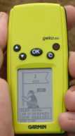
I have been using GPS for quite a number of years for my botanical
research/interest as well as outdoor pursuits. I bought my first GPS
receiver almost 15 years ago (1994) and used it extensively for
creating and mapping hiking trails, marking interesting botanical
finds, finding my way driving through Canada/US on holidays, measuring
perimeter and area of fields/plots, finding and mapping health
facilities, and much more.
I started doing basic GIS work with air photos and 'ground
truthing' over 20 years ago (1988) using image processing software
such as NIH Image and PhotoShop on the Mac. I also did some work with
Map II along with various CAD programs while working in the Faculty of
Architecture CAD lab. I use ArcView and ArcGIS extensively in my
current work to generate base maps and geocode locations. In
combination with GPS information I have worked with field data and
computerized raster/vector based GIS information.
Workshop Info
I have taught workshops on the use of GPS for canoeing, hiking and
more recently GeoCache hunts. Starting in 2000, in an attempt to reduce my workload, I started teaching workshops on the use of GIS in health. These workshops incude the use of
ArcView ® 3.x,
ArcGIS desktop® ,
fGIS
TM,
Epi MapTM, and some others.
I have posted some of the notes from
these workshops on the this page. I have also put a more general workshop together on navigation with Maps, Compass and GPS.
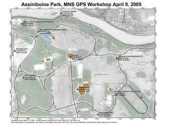
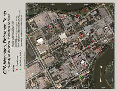
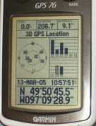
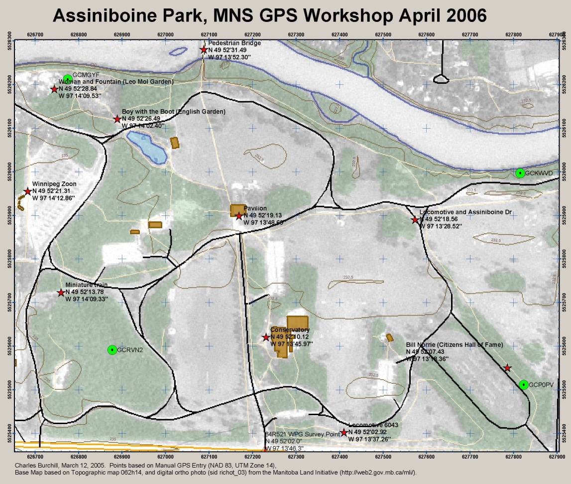
| I compiled some locations for GPS validation that the participants may find of use.
These points come from GeoBase
(http://www.geobase.ca/) Geodetic Network information on Federal 3-D
Densification Network, Canada, Level 1 (FED3DC1) - sheets 062H, 062I,
062O, 062P, 062J, 062G, 052L, 052E.
I have not confirmed that all of these sites still exist so use at your own risk.
Some of these sites may be on private land or areas with restricted access. Please
respect private property and ask permission of the land owner.
|
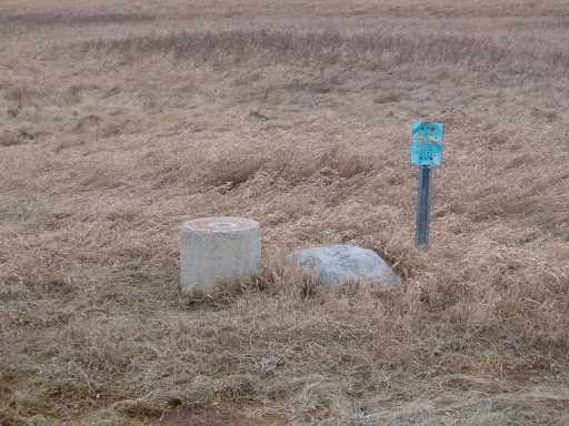
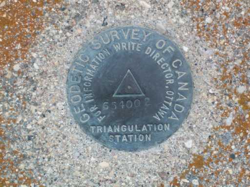
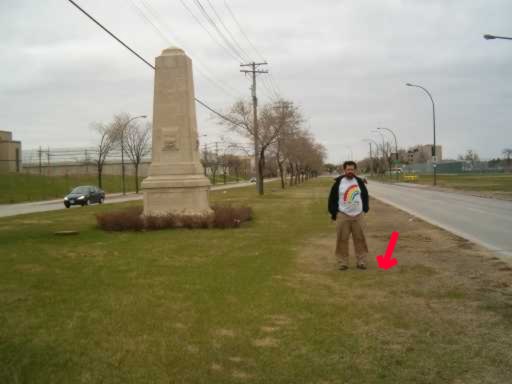
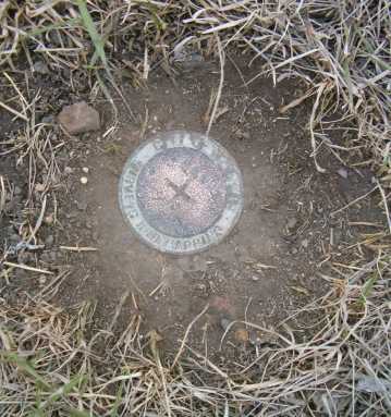
One of the questions I had, and have heard from others, is "what do these
survey point/benchmark things look like anyway"? Here are a couple of
examples.
Geodetic Survey of Canada Triangulation Station 654002
City of Winnipeg Surveys and Mapping point 84R611
General Information
GeoCaching
Utilities and GIS Source
Equipment Info
Some GPSr Manufacturers
Where to see, buy and sometimes get advice.
These are places that I have bought GPSr
equipment from and/or they
supported the workshops I have taught.
This list should not be taken as
a complete endorsement. Before you buy always
do some homework first.
Just remember when getting advice at stores
they will often try to
sell you up - know what you need before shopping
then listen to
their suggestions with a critical ear and ask questions!
That being said I have received excellent advice
from the places I have dealt with below. If possible try
out the GPSr under 'real' conditions not just the parking lot.
Shop in Winnipeg:
- Mountain Equipment
Co-op (MEC) Limited selection that is directed to the
self-propelled outdoor user. A good place to start.
- Cabela's
Directed at hunting/fishing but
have a lot of other things as well. I am not sure how things have changed with the move to Cabela's but lots of people I know frequent the store.
Shopping by Mail.
You should know what you want first and do your
own research. Don't expect in person support or demonstrations.
Some considerations when looking to buy a GPS receiver
Return to Home Page
Manitoba Nature Home Page
If you have any questions or comments please send me email:
burc...@cc.umanitoba.ca
Last modified: Thu Oct 29 08:24:29 2015